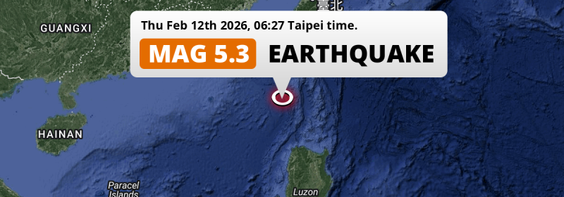
A shallow and significant M5.3 earthquake struck in the South China Sea 238 kilometer from Kaohsiung, Taiwan in the early morning of Thursday February 12th, 2026. Another country near the epicenter is The Philippines.
Felt the earthquake? Share this article: 


Earthquake Summary
This earthquake hit under water in the South China Sea, 173 kilometers (107 mi) off the coast of Taiwan, 238 kilometer south of Kaohsiung. The center of this earthquake had a very shallow depth of 15 km. Shallow earthquakes usually have a larger impact than earthquakes deep in the earth.
| Date and Time: | Feb 12, 2026 06:27 (Taipei Time) - Feb 11, 2026 22:27 Universal Time. |
|---|---|
| Location: | 238 km south of Kaohsiung, Taiwan. Coordinates 20°28'60"N 120°9'14"E. |
| Map: | 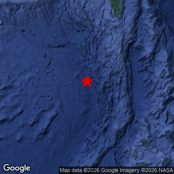 Map of area around epicenter. Click to open in Google Maps. |
| Magnitude: | MAG 5.3 Detected by 43 stations. Maximum Error Range ±0.089 . |
| Depth: | 15 km (9 mi) A very shallow depth. |
| Tsunami Risk: | Low tsunami risk Earthquakes under MAG-6.5 do not usually cause tsunami's. Always stay cautious - More info here. |
Nearby towns and cities
Taiwan and The Philippines are both located within 300km distance of the epicenter of the earthquake.
Located 180 kilometer (112 mi) south-southwest of the epicenter of this earthquake, Hengchun (Pingtung County, Taiwan) is the nearest significant population center.
Multiple large cities are in proximity of today's earthquake. Kaohsiung is located 238 km to the north. Tainan is located 279 km to the north. Laoag is located 258 km to the south.
The table below provides an overview of all places in proximity of today's earthquake.
Overview of nearby places
| Distance | Place |
|---|---|
| 180 km (112 mi) NNE from epicenter |
Hengchun Pingtung County, Taiwan. |
| 222 km (138 mi) N from epicenter |
Donggang Pingtung County, Taiwan. |
| 238 km (148 mi) N from epicenter |
Kaohsiung Kaohsiung, Taiwan. |
| 258 km (160 mi) S from epicenter |
Laoag Ilocos, The Philippines. |
| 261 km (162 mi) S from epicenter |
San Nicolas Ilocos, The Philippines. |
| 273 km (170 mi) S from epicenter |
Batac City Ilocos, The Philippines. |
| 279 km (173 mi) N from epicenter |
Tainan Tainan City, Taiwan. |
| 283 km (176 mi) SE from epicenter |
Aparri Cagayan Valley, The Philippines. |
| 295 km (183 mi) N from epicenter |
Yujing Tainan City, Taiwan. |
Aftershocks detected
After this earthquake struck, 1 smaller aftershock occurred. At a distance of 9 km (6 mi) south-east of this earthquake, an aftershock struck 44 mins later. It measured a magnitude of 3
Overview of foreshocks and aftershocks
| Classification | Magnitude | When | Where |
|---|---|---|---|
| Main Shock This Earthquake |
M 5.3 |
Feb 12, 2026 06:27 (Taipei Time) | - |
| Aftershock | M 3.0 |
44 mins later Feb 12, 2026 07:11 (Taipei Time) | 9 km (6 mi) SE from Main Shock. |
More earthquakes coming?
Earthquakes can create aftershocks. These are generally at least 1 magnitude lower than any main shock, and as time passes the chance and strength of aftershocks decreases.
The chance that a significant earthquake like this one is followed by an even larger earthquake is not so large. On average, scientists estimate a 94% chance that a major earthquake will not be followed by an even larger one. It is still adviced to be aware of this risk
Read: How to Stay Safe during an Earthquake (cdc.gov).Earthquakes like this happen often in the region
Earthquakes of this strength are very common in the region. This is the strongest earthquake to hit since December 24th, 2025, when a 6 magnitude earthquake hit 295 km (184 mi) further north-northeast. An even stronger magnitude 6.2 earthquake struck on September 12th, 2023.
In total, 47 earthquakes with a magnitude of 5.3 or higher have been registered within 300km (186 mi) of this epicenter in the past 10 years. This comes down to an average of once every 3 months.
Low tsunami risk
Based on early data it appears this earthquake was not strong enough (lower than MAG-6.5) to be likely to cause destructive tsunami's. However this earthquake appeared to have hit at a shallow depth under sea, so stay cautious and monitor advice from local authorities.
Tsunami Risk Factors
| Factor | Under Sea? | MAG-6.5 or stronger? | Shallow depth? |
|---|---|---|---|
| Explanation | Almost all tsunami's are caused by earthquakes with their epicenter under sea or very near the sea. However stay cautious in coastal areas as earthquakes on land may cause landslides into sea, potentially still causing a local tsunami. | Under MAG 6.5: Very unlikely to cause a tsunami. MAG 6.5 to 7.5: Destructive tsunami's do occur, but are uncommon. Likely to observe small sea level changes. MAG 7.6+: Earthquakes with these magnitudes might produce destructive tsunami's. |
Most destructive tsunami's are caused by shallow earthquakes with a depth between 0 and 100km under the surface of the earth. Deeper tsunami's are unlikely to displace to ocean floor. |
| This Earthquake | This earthquake appears to have struck under the sea. | Not this earthquake. This earthquake had a magnitude of 5.3. Earthquakes of this strength are unlikely to trigger a tsunami. |
This earthquake occurred at a depth of of 15 km (9 mi). Earthquakes this shallow could trigger a tsunami. |
Sources
Last updated 18/02/26 22:08 (). This article is automatically generated based on available data. We keep checking multiple sources for additional information. This article gets updated as new details on this earthquake become available.
- US Geographic Society (USGS): Earthquake us6000s80p
- European-Mediterranean Seismological Centre (EMSC): Earthquake 20260211_0000355
- Geonames.org: World Cities Database
- Google Maps: Static API
- Earthquakelist.org: Historic Earthquakes Database
Share this article:
