Latest earthquakes near Honduras today
Complete overview of the latest earthquakes near the country Honduras, updated every minute. Did you feel an earthquake today in Honduras? If an earthquake is happening right now near Honduras, it will show up within minutes.
Recent Honduras Earthquake News
These are the latest articles published related to earthquakes occurring near Honduras. Check our Earthquake News section for a complete overview of articles written on earthquakes near Honduras and elsewhere.
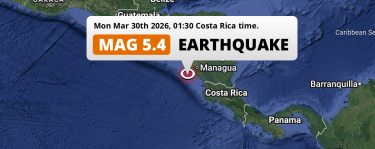 Mar 30, 2026 01:30AM
Significant M5.4 Earthquake struck on Monday Night in the North Pacific Ocean 106km from Managua (Nicaragua).
Mar 30, 2026 01:30AM
Significant M5.4 Earthquake struck on Monday Night in the North Pacific Ocean 106km from Managua (Nicaragua).
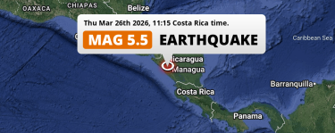 Mar 26, 2026 11:15AM
Significant M5.5 Earthquake hit near Managua in Nicaragua on Thursday Morning.
Mar 26, 2026 11:15AM
Significant M5.5 Earthquake hit near Managua in Nicaragua on Thursday Morning.
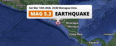 Mar 14, 2026 11:00PM
Significant M5.3 Earthquake struck on Saturday Evening in the North Pacific Ocean near San Miguel (El Salvador).
Mar 14, 2026 11:00PM
Significant M5.3 Earthquake struck on Saturday Evening in the North Pacific Ocean near San Miguel (El Salvador).
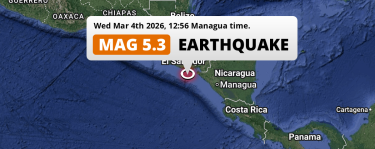 Mar 4, 2026 12:56PM
Significant M5.3 Earthquake struck on Wednesday Afternoon in the North Pacific Ocean near Usulután (El Salvador).
Mar 4, 2026 12:56PM
Significant M5.3 Earthquake struck on Wednesday Afternoon in the North Pacific Ocean near Usulután (El Salvador).
Honduras Earthquake Statistics
Average
A total of 2651 earthquakes with a magnitude of four or above have struck within 300 km (186 mi) of Honduras in the past 10 years. This comes down to a yearly average of 265 earthquakes per year, or 22 per month. On average an earthquake will hit near Honduras roughly every 1 days.
A relatively large number of earthquakes occurred near Honduras in 2022. A total of 296 earthquakes (mag 4+) were detected within 300 km of Honduras that year. The strongest had a 6.6 magnitude.

Magnitude Distribution
The table below visualizes the distribution of all earthquakes that occurred within 300km of Honduras in the past 10 years. No earthquakes with a magnitude of 7 or above have occurred near Honduras during this time. Usually, higher magnitudes are less common than lower magnitudes. Small earthquakes with a magnitude below 4 on the Richter scale have been omitted from this overview.
| Magnitude | Earthquakes | Percentage |
|---|---|---|
| Mag. 4 | 2492 | 94.0% |
| Mag. 5 | 148 | 5.58% |
| Mag. 6 | 11 | 0.41% |
| Mag. 7 | 0 | 0.0% |
| Mag. 8 | 0 | 0.0% |
| Mag. 9 | 0 | 0.0% |
| Mag. 10 | 0 | 0.0% |
Strongest earthquakes near Honduras
The strongest recent earthquake of the past 10 years near Honduras occurred on Apr 21, 2022 01:42 local time (America/Tegucigalpa timezone). It had a magnitude of 6.6 and struck 282 kilometers (175 mi) south of Tegucigalpa, at a depth of 27 km. Discover more strong earthquakes near Honduras in the list below.
A longer time ago, a MAG-7.7 earthquake struck on Sep 1, 1992 18:16, 261 kilometers (162 mi) south of Tegucigalpa. It is the strongest earthquake near Honduras in the past 126 years (Our data goes back to January 1st, 1900).
In the table below you will find the strongest earthquakes that occurred near Honduras in the past 10 years. You can use the tabs to find the heaviest historic earthquakes since the year 1900 or within a specific year or distance from Honduras.
Earthquakes by region of Honduras
Click the links below for earthquake reports for regions in Honduras.
- Atlántida
- Choluteca
- Colón
- Comayagua
- Copán
- Cortés
- El Paraíso
- Francisco Morazán
- La Paz
- Olancho
- Santa Bárbara
- Valle
- Yoro
Frequently Asked Questions
These questions are commonly asked in relation to earthquakes occurring near Honduras.
When was the last earthquake in Honduras?
A 2.9 magnitude earthquake hit near Honduras on the night of April 1, 2026 at 01:03 local time (America/Tegucigalpa). The center of this earthquake was located 181km southwest of Tegucigalpa at a depth of 31km under water in the North Pacific Ocean. Check the list on our website for any earthquakes occurring near Honduras in the past hours.
What was the strongest earthquake near Honduras?
A 7.7 magnitude earthquake hit near Honduras on the evening of September 1, 1992 at 18:16 local time (America/Tegucigalpa). The center of this earthquake was located 261km south of Tegucigalpa at a depth of 45km under water in the North Pacific Ocean. This is the strongest earthquake that occurred near Honduras since the year 1900.
How often do earthquakes occur near Honduras?
In the past 10 years, 2651 earthquakes with a magnitude of four or higher occurred within a 300 kilometer range from Honduras. This averages to 265 earthquakes yearly, or one earthquake every 1 days.
