Latest earthquakes near Russia today
Complete overview of the latest earthquakes near the country Russia, updated every minute. Did you feel an earthquake today in Russia? If an earthquake is happening right now near Russia, it will show up within minutes.
Recent Russia Earthquake News
These are the latest articles published related to earthquakes occurring near Russia. Check our Earthquake News section for a complete overview of articles written on earthquakes near Russia and elsewhere.
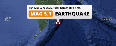 Mar 22, 2026 07:19PM
Shallow M5.1 Earthquake struck on Sunday Evening in the North Pacific Ocean 180km from Petropavlovsk-Kamchatsky (Russia).
Mar 22, 2026 07:19PM
Shallow M5.1 Earthquake struck on Sunday Evening in the North Pacific Ocean 180km from Petropavlovsk-Kamchatsky (Russia).
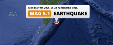 Mar 9, 2026 05:23AM
Shallow M5.1 AFTERSHOCK hit in the North Pacific Ocean 188km from Petropavlovsk-Kamchatsky (Russia) on Monday Night.
Mar 9, 2026 05:23AM
Shallow M5.1 AFTERSHOCK hit in the North Pacific Ocean 188km from Petropavlovsk-Kamchatsky (Russia) on Monday Night.
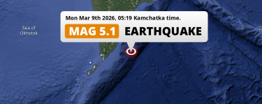 Mar 9, 2026 05:19AM
Shallow M5.1 AFTERSHOCK hit in the North Pacific Ocean 198km from Petropavlovsk-Kamchatsky (Russia) on Monday Night.
Mar 9, 2026 05:19AM
Shallow M5.1 AFTERSHOCK hit in the North Pacific Ocean 198km from Petropavlovsk-Kamchatsky (Russia) on Monday Night.
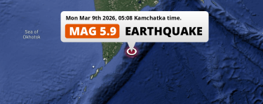 Mar 9, 2026 05:08AM
Shallow M5.9 Earthquake struck on Monday Night in the North Pacific Ocean 165km from Petropavlovsk-Kamchatsky (Russia).
Mar 9, 2026 05:08AM
Shallow M5.9 Earthquake struck on Monday Night in the North Pacific Ocean 165km from Petropavlovsk-Kamchatsky (Russia).
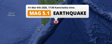 Mar 6, 2026 05:00PM
Shallow M5.1 FORESHOCK hit in the North Pacific Ocean 186km from Petropavlovsk-Kamchatsky (Russia) on Friday Afternoon.
Mar 6, 2026 05:00PM
Shallow M5.1 FORESHOCK hit in the North Pacific Ocean 186km from Petropavlovsk-Kamchatsky (Russia) on Friday Afternoon.
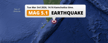 Mar 3, 2026 02:16PM
On Tuesday Afternoon a Shallow M4.9 Earthquake struck in the North Pacific Ocean 242km from Petropavlovsk-Kamchatsky (Russia).
Mar 3, 2026 02:16PM
On Tuesday Afternoon a Shallow M4.9 Earthquake struck in the North Pacific Ocean 242km from Petropavlovsk-Kamchatsky (Russia).
Russia Earthquake Statistics
Average
A total of 5871 earthquakes with a magnitude of four or above have struck within 300 km (186 mi) of Russia in the past 10 years. This comes down to a yearly average of 587 earthquakes per year, or 48 per month. On average an earthquake will hit near Russia roughly every 14 hours.
A relatively large number of earthquakes occurred near Russia in 2025. A total of 3597 earthquakes (mag 4+) were detected within 300 km of Russia that year. The strongest had a 8.8 magnitude.

Magnitude Distribution
The table below visualizes the distribution of all earthquakes that occurred within 300km of Russia in the past 10 years. No earthquakes with a magnitude of 9 or above have occurred near Russia during this time. Usually, higher magnitudes are less common than lower magnitudes. Small earthquakes with a magnitude below 4 on the Richter scale have been omitted from this overview.
| Magnitude | Earthquakes | Percentage |
|---|---|---|
| Mag. 4 | 5296 | 90.21% |
| Mag. 5 | 540 | 9.2% |
| Mag. 6 | 30 | 0.51% |
| Mag. 7 | 4 | 0.07% |
| Mag. 8 | 1 | 0.02% |
| Mag. 9 | 0 | 0.0% |
| Mag. 10 | 0 | 0.0% |
Strongest earthquakes near Russia
The strongest recent earthquake of the past 10 years near Russia occurred on Jul 30, 2025 11:24 local time (Asia/Kamchatka timezone). It had a magnitude of 8.8 and struck 126 kilometers (78 mi) east-southeast of Petropavlovsk-Kamchatsky, at a depth of 35 km. Discover more strong earthquakes near Russia in the list below.
A longer time ago, a MAG-9 earthquake struck on Nov 5, 1952 04:58, 92 kilometers (57 mi) east-southeast of Petropavlovsk-Kamchatsky. It is the strongest earthquake near Russia in the past 126 years (Our data goes back to January 1st, 1900).
In the table below you will find the strongest earthquakes that occurred near Russia in the past 10 years. You can use the tabs to find the heaviest historic earthquakes since the year 1900 or within a specific year or distance from Russia.
Earthquakes by region of Russia
Click the links below for earthquake reports for regions in Russia.
- Adygeya Republic (Адыгея)
- Altai (Алтай)
- Altai Krai (Алтайский край)
- Amur Oblast (Амурская область)
- Astrakhan (Астраханская область)
- Bashkortostan Republic (Башкортостан)
- Belgorod Oblast (Belgorod)
- Buryatiya Republic (Бурятия)
- Chechnya (Chechenskaya Respublika)
- Chelyabinsk (Челябинская)
- Dagestan (Дагестан)
- Ingushetiya Republic (Ingushetiya)
- Irkutsk Oblast (Иркутская область)
- Ivanovo (Ивановская область)
- Jewish Autonomous Oblast (犹太自治州)
- Kabardino-Balkariya Republic (Kabardino-Balkariya)
- Kalmykiya Republic (Калмыкия)
- Kaluga (Калужская область)
- Kamchatka (Камчатский край)
- Karachayevo-Cherkesiya Republic (Карачаево-Черкессия)
- Karelia (Karjala)
- Kemerovo Oblast (Кемеровская область)
- Khabarovsk (Хабаровский край)
- Khakasiya Republic (Хакасия)
- Khanty-Mansia (Ханты-Мансийский АО)
- Kostroma Oblast (Костромская область)
- Krasnodarskiy (Краснодарский край)
- Krasnoyarskiy (Красноярский край)
- Kursk
- Leningradskaya Oblast' (Leningrad Oblast)
- Magadan Oblast (Магаданская область)
- Moscow (Москва)
- Moscow Oblast (Московская область)
- Murmansk (Мурманская область)
- Nizhny Novgorod Oblast (Нижегородская область)
- North Ossetia (Severnaya Osetiya-Alaniya)
- Novgorod Oblast (Novgorod)
- Novosibirsk Oblast (Новосибирская область)
- Omsk (Омская область)
- Perm (Пермский край)
- Primorskiy (Maritime) Kray (Primorskiy)
- Pskov Oblast (Pskov)
- Republic of Tyva (Тува)
- Rostov (Ростовская область)
- Ryazan Oblast (Рязанская область)
- Sakha (Саха (Якутия))
- Sakhalin Oblast (Сахалин)
- Saratovskaya Oblast (Саратовская область)
- Smolenskaya Oblast’ (Smolensk)
- St.-Petersburg (Peterburi)
- Stavropol’ Kray (Ставрополье)
- Sverdlovsk (Свердловская область)
- Tomsk Oblast (Томская область)
- Transbaikal Territory (Забайкальский Край)
- Tula (Тульская область)
- Tver’ Oblast (Tverskaya)
- Udmurtiya Republic (Удмуртия)
- Vladimir (Владимирская область)
- Volgograd Oblast (Волгоградская область)
- Yaroslavl Oblast (Ярославская область)
Frequently Asked Questions
These questions are commonly asked in relation to earthquakes occurring near Russia.
When was the last earthquake in Russia?
A 4.4 magnitude earthquake hit near Russia on the afternoon of April 1, 2026 at 15:43 local time (Asia/Irkutsk). The center of this earthquake was located 238km east of Severobaykal’sk at a depth of 10km under land. Check the list on our website for any earthquakes occurring near Russia in the past hours.
What was the strongest earthquake near Russia?
A 9 magnitude earthquake hit near Russia on the night of November 5, 1952 at 04:58 local time (Asia/Kamchatka). The center of this earthquake was located 92km east-southeast of Petropavlovsk-Kamchatsky at a depth of 22km under water in the North Pacific Ocean. This is the strongest earthquake that occurred near Russia since the year 1900.
How often do earthquakes occur near Russia?
In the past 10 years, 5871 earthquakes with a magnitude of four or higher occurred within a 300 kilometer range from Russia. This averages to 587 earthquakes yearly, or one earthquake every 15 hours.
