Latest earthquakes near Panama today
Complete overview of the latest earthquakes near the country Panama, updated every minute. Did you feel an earthquake today in Panama? If an earthquake is happening right now near Panama (also known as Panamá), it will show up within minutes.
Recent Panama Earthquake News
These are the latest articles published related to earthquakes occurring near Panama. Check our Earthquake News section for a complete overview of articles written on earthquakes near Panama and elsewhere.
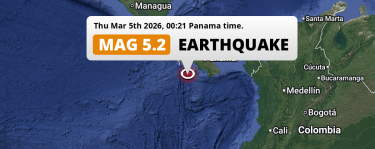 Mar 5, 2026 12:21AM
Shallow M5.2 Earthquake struck on Thursday Night in the North Pacific Ocean 145km from David (Panama).
Mar 5, 2026 12:21AM
Shallow M5.2 Earthquake struck on Thursday Night in the North Pacific Ocean 145km from David (Panama).
Panama Earthquake Statistics
Average
A total of 1359 earthquakes with a magnitude of four or above have struck within 300 km (186 mi) of Panama in the past 10 years. This comes down to a yearly average of 135 earthquakes per year, or 11 per month. On average an earthquake will hit near Panama roughly every 2 days.
A relatively large number of earthquakes occurred near Panama in 2022. A total of 181 earthquakes (mag 4+) were detected within 300 km of Panama that year. The strongest had a 6.7 magnitude.

Magnitude Distribution
The table below visualizes the distribution of all earthquakes that occurred within 300km of Panama in the past 10 years. No earthquakes with a magnitude of 7 or above have occurred near Panama during this time. Usually, higher magnitudes are less common than lower magnitudes. Small earthquakes with a magnitude below 4 on the Richter scale have been omitted from this overview.
| Magnitude | Earthquakes | Percentage |
|---|---|---|
| Mag. 4 | 1276 | 93.89% |
| Mag. 5 | 70 | 5.15% |
| Mag. 6 | 13 | 0.96% |
| Mag. 7 | 0 | 0.0% |
| Mag. 8 | 0 | 0.0% |
| Mag. 9 | 0 | 0.0% |
| Mag. 10 | 0 | 0.0% |
Strongest earthquakes near Panama
The strongest recent earthquake of the past 10 years near Panama occurred on Oct 20, 2022 06:57 local time (America/Panama timezone). It had a magnitude of 6.7 and struck 83 kilometers (52 mi) south of David, at a depth of 20 km. Discover more strong earthquakes near Panama in the list below.
A longer time ago, a MAG-7.6 earthquake struck on Apr 22, 1991 16:56, 67 kilometers (42 mi) south of Changuinola. It is the strongest earthquake near Panama in the past 126 years (Our data goes back to January 1st, 1900).
In the table below you will find the strongest earthquakes that occurred near Panama in the past 10 years. You can use the tabs to find the heaviest historic earthquakes since the year 1900 or within a specific year or distance from Panama.
Earthquakes by region of Panama
Click the links below for earthquake reports for regions in Panama.
Frequently Asked Questions
These questions are commonly asked in relation to earthquakes occurring near Panama.
When was the last earthquake in Panama?
A 4.4 magnitude earthquake hit near Panama on the morning of April 1, 2026 at 06:23 local time (America/Panama). The center of this earthquake was located 223km south of David at a depth of 206km under water in the North Pacific Ocean. Check the list on our website for any earthquakes occurring near Panama in the past hours.
What was the strongest earthquake near Panama?
A 7.6 magnitude earthquake hit near Panama on the afternoon of April 22, 1991 at 16:56 local time (America/Panama). The center of this earthquake was located 67km west-northwest of Changuinola at a depth of 10km under land. This is the strongest earthquake that occurred near Panama since the year 1900.
How often do earthquakes occur near Panama?
In the past 10 years, 1359 earthquakes with a magnitude of four or higher occurred within a 300 kilometer range from Panama. This averages to 136 earthquakes yearly, or one earthquake every 3 days.
