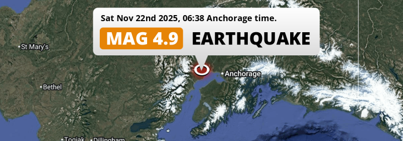
A M4.9 earthquake struck under land 45 miles from Anchorage in The United States in the early morning of Saturday November 22nd, 2025. Shaking may have been felt by a total of 470 thousand people.
Felt the earthquake? Share this article: 


Earthquake Summary
The earthquake struck on land in The United States, 45 miles (72 km) west of Anchorage in Alaska. The center of this earthquake had a quite shallow depth of 38 km. Shallow earthquakes usually have a larger impact than earthquakes deep in the earth.
| Date and Time: | Nov 22, 2025 06:38AM (Anchorage Time) - Nov 22, 2025 15:38 Universal Time. |
|---|---|
| Location: | 45 mi west of Anchorage, Alaska, The United States. Coordinates 61°11'41"N 151°14'31"W. |
| Map: | 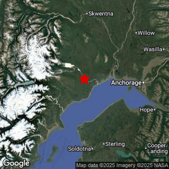 Map of area around epicenter. Click to open in Google Maps. |
| Magnitude: | MAG 4.9 Detected by 70 stations. Maximum Error Range ±0.037 . |
| Depth: | 38 mi (62 km) A quite shallow depth. |
| Max. Intensity: | IV
Light On the Modified Mercalli Scale. |
| Tsunami Risk: | Tsunami very unlikely While this was a shallow earthquake in a coastal area, it appears to have occurred under land (7 mi from the sea) with a magnitude that is usually not strong enough to cause tsunami's. Always stay cautious - More info here. |
Minimal impact predicted
Based on scientific estimates by the US Geographic Survey (USGS), the risk of high fatalities for this earthquake is classified at level GREEN (low). They expect an 69% likelyhood of between 0 and 1 fatalities, and a 98% chance that the number of fatalities falls no higher than 10.
The USGS classifies the economic impact of this earthquake at level GREEN (low). They expect an 65% likelyhood of between 0 and 1 million US Dollars in economic damage and impact, and a 96% chance that the economic impact of this earthquake falls no higher than 10 million USD.
Roughly 470 thousand people exposed to shaking
This earthquake may have been felt by around 470 thousand people. That is the expected population size of the area exposed to a level of shaking of II or higher on the Modified Mercalli scale according to the USGS.
Light shaking and likely no damage may have been experienced by an estimated 20 people. At IV, it is the highest MMI level this earthquake has caused. Intensity level III was experienced by the majority of people (around 390 thousand). In their region, weak shaking and probably no damage can be expected.
| People | MMI Level | Shaking | Damage |
|---|---|---|---|
| 330 | I |
Not noticable | None |
| 82,880 | II |
Very weak | None |
| 387,500 | III |
Weak | Probably none |
| 20 | IV |
Light | Likely none |
| 0 | V |
Moderate | Very light |
| 0 | VI |
Strong | Light |
| 0 | VII |
Very Strong | Moderate |
| 0 | VIII |
Severe | Moderate to heavy |
| 0 | IX |
Violent | Heavy |
| 0 | X |
Extreme | Very heavy |
Nearby towns and cities
This earthquake may have been felt in The United States . The closest significant population center near the earthquake is Anchorage in Alaska, The United States. Anchorage is located 45 miles (72 km) west of the epicenter. The intensity of shaking and damage in Anchorage is estimated to be around level III on the Modified Mercalli Intensity scale (weak shaking, probably no damage).
Overview of nearby places
| Distance | Place | Intensity (MMI) |
|---|---|---|
| 45 mi (72 km) E from epicenter |
Anchorage Alaska, The United States. |
III
Weak |
| 57 mi (91 km) E from epicenter |
Eagle River Alaska, The United States. |
III
Weak |
Earthquake Intensity Map
The intensity in shaking and damage by this earthquake is illustrated through the map below. The highest intensity measured for this earthquake is IV.

6 Aftershocks detected
After this earthquake struck, 6 smaller aftershocks occurred. At a distance of 2.5 mi (4 km) west of this earthquake, an aftershock struck 2 days later. It measured a magnitude of 3.3
In the days before this main shock, 1 smaller foreshock was detected. Roughly 2 days before this earthquake, a foreshock measuring MAG-2.8 was detected nearby this earthquake.
Overview of foreshocks and aftershocks
| Classification | Magnitude | When | Where |
|---|---|---|---|
| Foreshock | M 2.8 |
2 days earlier Nov 20, 2025 02:37PM (Anchorage Time) | 56 mi (91 km) ENE from Main Shock. |
| Main Shock This Earthquake |
M 4.9 |
Nov 22, 2025 06:38AM (Anchorage Time) | - |
| Aftershock | M 3.1 |
17 hrs later Nov 22, 2025 11:52PM (Anchorage Time) | 54 mi (87 km) SSE from Main Shock. |
| Aftershock | M 3.3 |
2 days later Nov 23, 2025 07:14PM (Anchorage Time) | 2.5 mi (4 km) W from Main Shock. |
| Aftershock | M 3.1 |
2 days later Nov 23, 2025 09:01PM (Anchorage Time) | 49 mi (79 km) ENE from Main Shock. |
| Aftershock | M 2.5 |
2 days later Nov 24, 2025 05:14AM (Anchorage Time) | 50 mi (80 km) ENE from Main Shock. |
| Aftershock | M 3.0 |
3 days later Nov 24, 2025 10:44PM (Anchorage Time) | 35 mi (57 km) E from Main Shock. |
| Aftershock | M 2.6 |
3 days later Nov 25, 2025 04:49AM (Anchorage Time) | 40 mi (65 km) NE from Main Shock. |
More earthquakes coming?
The risk of aftershocks decreases rapidly over time. Usually, aftershocks are at least one order of magnitude lower than a main shock.
In only six percent of cases, significant earthquakes are followed by a larger main shock, making the current earthquake a foreshock. While the chance of this happening is not so large, it is adviced to maintain cautiousness in the hours and days following a major earthquake.
Read: How to Stay Safe during an Earthquake (cdc.gov).Earthquakes like this happen often in the region
Earthquakes of this strength are very common in the region. This is the strongest earthquake to hit since October 30th, 2025, when a 5.4 magnitude earthquake hit 113 mi (182 km) further south-southeast. An even stronger magnitude 7.1 earthquake struck on November 30th, 2018.
In total, 42 earthquakes with a magnitude of 4.9 or higher have been registered within 300km (186 mi) of this epicenter in the past 10 years. This comes down to an average of once every 3 months.
Tsunami very unlikely
While MAG-6.5+ earthquakes may cause tsunami's, it appears that the epicenter of this earthquake hit under land. In addition, the reported depth is deeper than 100km, making the risk of a tsunami even less likely. However always stay cautious and monitor advice from local authorities.
Tsunami Risk Factors
| Factor | Under Sea? | MAG-6.5 or stronger? | Shallow depth? |
|---|---|---|---|
| Explanation | Almost all tsunami's are caused by earthquakes with their epicenter under sea or very near the sea. However stay cautious in coastal areas as earthquakes on land may cause landslides into sea, potentially still causing a local tsunami. | Under MAG 6.5: Very unlikely to cause a tsunami. MAG 6.5 to 7.5: Destructive tsunami's do occur, but are uncommon. Likely to observe small sea level changes. MAG 7.6+: Earthquakes with these magnitudes might produce destructive tsunami's. |
Most destructive tsunami's are caused by shallow earthquakes with a depth between 0 and 100km under the surface of the earth. Deeper tsunami's are unlikely to displace to ocean floor. |
| This Earthquake | This earthquake appears to have struck on land near a coastal area (7 mi from the sea). | Not this earthquake. This earthquake had a magnitude of 4.9. Earthquakes of this strength are unlikely to trigger a tsunami. |
This earthquake occurred at a depth of of 38 mi (62 km). Earthquakes this shallow could trigger a tsunami. |
Sources
Last updated 21/01/26 06:18 (). This article contains currently available information about the earthquake and is automatically composed. We continue to update this article up to a few days after the earthquake occurred.
- US Geographic Society (USGS): Earthquake ak2025wzudcl
- European-Mediterranean Seismological Centre (EMSC): Earthquake 20251122_0000221
- Geonames.org: World Cities Database
- Google Maps: Static API
- Earthquakelist.org: Historic Earthquakes Database
Share this article:
