In the Aegean Sea 89 kilometer from Irákleion, Greece, a strong M6.2 earthquake occurred in the early morning of Thursday May 22nd, 2025. Earthquakes like this can cause significant economic damage and have a significant risk at casualties. Another nearby country is Türkiye.
Felt the earthquake? Share this article: 


Earthquake Summary
This earthquake hit under water in the Aegean Sea, 62 kilometers (39 mi) off the coast of Greece, 89 kilometer north-east of Irákleion in Crete. The center of this earthquake had a quite shallow depth of 64 km. Shallow earthquakes usually have a larger impact than earthquakes deep in the earth.
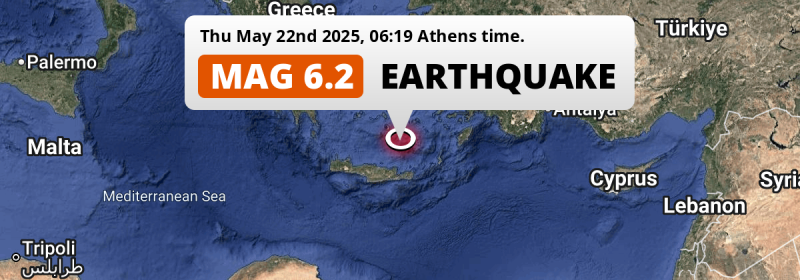
| Date and Time: | May 22, 2025 06:19 (Athens Time) - May 22, 2025 03:19 Universal Time. |
|---|---|
| Location: | 89 km NE of Irákleion, Crete, Greece. Coordinates 35°52'49"N 25°51'23"E. |
| Map: |  Map of area around epicenter. Click to open in Google Maps. |
| Magnitude: | MAG 6.2 Detected by 75 stations. Maximum Error Range ±0.036 . |
| Depth: | 64 km (40 mi) A quite shallow depth. |
| Max. Intensity: | VII
Very Strong On the Modified Mercalli Scale. |
| Tsunami Risk: | Low tsunami risk Earthquakes under MAG-6.5 do not usually cause tsunami's. Always stay cautious - More info here. |
Significant impact predicted
The US Geographic Survey (USGS) describes the impact of this earthquake as follows:
Several homes and buildings damaged; landslides reported in the Heraklion area. A small tsunami with a maximum wave height of 5 cm was recorded at Irakleio.
Based on scientific estimates by the USGS, the risk of high fatalities for this earthquake is classified at level YELLOW (significant). They expect an 48% likelyhood of between 1 and 10 fatalities, and a 99% chance that the number of fatalities falls no higher than 100.
The USGS classifies the economic impact of this earthquake at level YELLOW (significant). They expect an 35% likelyhood of between 10 and 100 million US Dollars in economic damage and impact, and a 92% chance that the economic impact of this earthquake falls between 1 and 10,000 million USD.
Roughly 2.1 million people exposed to shaking
The USGS has published a report estimating the number of people exposed to this earthquake. Acoording to their analysis, roughly 2.1 million have been exposed to shaking at an MMI level of II or higher.
The highest earthquake impact level for this earthquake is VII, which corresponds with very strong shaking and likely moderate damage. Roughly 98,870 people are expected to be exposed to this level. Intensity level IV was experienced by a large group of people (around 1 million). In their region, light shaking and likely no damage can be expected.
People in 2 countries have been exposed to shaking. Roughly 1 million people were exposed to shaking in Greece , with level VII (very strong shaking, likely moderate damage) as the highest recorded. In Türkiye , around 1.1 million people.
| People | MMI Level | Shaking | Damage |
|---|---|---|---|
| 0 | I |
Not noticable | None |
| 0 | II |
Very weak | None |
| 809,100 | III |
Weak | Probably none |
| 1,018,000 | IV |
Light | Likely none |
| 91,960 | V |
Moderate | Very light |
| 100,100 | VI |
Strong | Light |
| 98,870 | VII |
Very Strong | Moderate |
| 0 | VIII |
Severe | Moderate to heavy |
| 0 | IX |
Violent | Heavy |
| 0 | X |
Extreme | Very heavy |
Nearby towns and cities
Greece and Türkiye are both located within 300km distance of the epicenter of the earthquake.
Irákleion in Crete, Greece is the nearest significant place from the epicenter. The earthquake occurred 89 kilometer (55 mi) north-east of Irákleion. Irákleion experienced an earthquake intensity (MMI Scale) of roughly VII. That level implies very strong shaking and likely moderate damage.
Multiple major population centers exist within 300km of the earthquake that struck today. İzmir is located 304 km to the north-northeast (intensity unknown, possibly low). Athens is located 301 km to the northwest (intensity unknown, possibly low). Irákleion is located 89 km to the southwest and experienced an intensity of VII (very strong shaking, likely moderate damage).
A complete list of nearby places is included below. Estimated intensity data (MMI) sourced from a shake-map published by the US Geographic Survey is shown where available (cities without data probably experienced little impact).
Overview of nearby places
| Distance | Place | Intensity (MMI) |
|---|---|---|
| 89 km (55 mi) SW from epicenter |
Irákleion Crete, Greece. |
VII
Very Strong |
| 137 km (85 mi) WSW from epicenter |
Rethymno Crete, Greece. |
IV
Light |
| 170 km (106 mi) WSW from epicenter |
Chaniá Crete, Greece. |
IV
Light |
| 171 km (106 mi) NE from epicenter |
Kos South Aegean, Greece. |
IV
Light |
| 179 km (111 mi) NE from epicenter |
Turgutreis Muğla, Türkiye. |
IV
Light |
| 191 km (119 mi) NE from epicenter |
Bodrum Muğla, Türkiye. |
III
Weak |
| 209 km (130 mi) NE from epicenter |
Didim Aydın, Türkiye. |
III
Weak |
| 221 km (137 mi) ENE from epicenter |
Ródos South Aegean, Greece. |
IV
Light |
| 235 km (146 mi) NE from epicenter |
Milas Muğla, Türkiye. |
IV
Light |
| 242 km (150 mi) ENE from epicenter |
Marmaris Muğla, Türkiye. |
IV
Light |
| 249 km (155 mi) NNE from epicenter |
Söke Aydın, Türkiye. |
III
Weak |
| 253 km (157 mi) NNE from epicenter |
Kuşadası Aydın, Türkiye. |
|
| 267 km (166 mi) NNE from epicenter |
Selçuk İzmir, Türkiye. |
|
| 269 km (167 mi) NE from epicenter |
Muğla Muğla, Türkiye. |
|
| 278 km (173 mi) N from epicenter |
Chios North Aegean, Greece. |
|
| 281 km (175 mi) NE from epicenter |
Aydın Aydın, Türkiye. |
|
| 283 km (176 mi) NNE from epicenter |
Urla İzmir, Türkiye. |
|
| 286 km (178 mi) NNE from epicenter |
Torbalı İzmir, Türkiye. |
|
| 289 km (180 mi) NW from epicenter |
Glyfáda Attica, Greece. |
|
| 293 km (182 mi) NW from epicenter |
Argyroúpoli Attica, Greece. |
|
| 294 km (183 mi) NW from epicenter |
Ilioúpoli Attica, Greece. |
|
| 295 km (183 mi) NW from epicenter |
Álimos Attica, Greece. |
|
| 296 km (184 mi) NW from epicenter |
Agios Dimitrios Attica, Greece. |
|
| 297 km (185 mi) NW from epicenter |
Výronas Attica, Greece. |
|
| 297 km (185 mi) NE from epicenter |
Tire İzmir, Türkiye. |
|
| 298 km (185 mi) NW from epicenter |
Agía Paraskeví Attica, Greece. |
|
| 298 km (185 mi) NW from epicenter |
Néa Smýrni Attica, Greece. |
|
| 298 km (185 mi) NW from epicenter |
Palaió Fáliro Attica, Greece. |
|
| 298 km (185 mi) NW from epicenter |
Zográfos Attica, Greece. |
|
| 300 km (186 mi) NW from epicenter |
Khalándrion Attica, Greece. |
|
| 300 km (186 mi) NW from epicenter |
Kallithéa Attica, Greece. |
|
| 300 km (186 mi) NNE from epicenter |
Karabağlar İzmir, Türkiye. |
|
| 301 km (187 mi) NW from epicenter |
Athens Attica, Greece. |
|
| 302 km (188 mi) NW from epicenter |
Galátsi Attica, Greece. |
|
| 302 km (188 mi) NW from epicenter |
Piraeus Attica, Greece. |
|
| 303 km (188 mi) NW from epicenter |
Aigáleo Attica, Greece. |
|
| 303 km (188 mi) NW from epicenter |
Maroúsi Attica, Greece. |
|
| 304 km (189 mi) NW from epicenter |
Níkaia Attica, Greece. |
|
| 304 km (189 mi) NW from epicenter |
Néa Ionía Attica, Greece. |
|
| 304 km (189 mi) NNE from epicenter |
İzmir İzmir, Türkiye. |
|
| 305 km (190 mi) NW from epicenter |
Korydallós Attica, Greece. |
|
| 305 km (190 mi) NW from epicenter |
Keratsíni Attica, Greece. |
|
| 306 km (190 mi) NW from epicenter |
Peristéri Attica, Greece. |
|
| 307 km (191 mi) NW from epicenter |
Ílion Attica, Greece. |
|
| 309 km (192 mi) NW from epicenter |
Acharnés Attica, Greece. |
|
| 315 km (196 mi) NE from epicenter |
Nazilli Aydın, Türkiye. |
|
| 321 km (199 mi) NE from epicenter |
Ödemiş İzmir, Türkiye. |
|
| 333 km (207 mi) NNE from epicenter |
Turgutlu Manisa, Türkiye. |
|
| 334 km (208 mi) NNE from epicenter |
Manisa Manisa, Türkiye. |
|
| 350 km (217 mi) NW from epicenter |
Chalkída Central Greece, Greece. |
|
| 353 km (219 mi) NE from epicenter |
Salihli Manisa, Türkiye. |
|
| 355 km (221 mi) NE from epicenter |
Merkezefendi Denizli, Türkiye. |
|
| 356 km (221 mi) NE from epicenter |
Denizli Denizli, Türkiye. |
|
| 359 km (223 mi) WNW from epicenter |
Kalamata Peloponnese, Greece. |
|
| 376 km (234 mi) ENE from epicenter |
Elmalı Antalya, Türkiye. |
|
| 389 km (242 mi) N from epicenter |
Ayvalık Balıkesir, Türkiye. |
Earthquake Intensity Map
The intensity in shaking and damage by this earthquake is illustrated through the map below. The highest intensity measured for this earthquake is VII.

Shaking reported by 808 people in 10 countries
People that feel an earthquake may report their experience to the US Geographic Survey. Currently, 808 people have reported shaking in 166 places in 10 countries (Cyprus, Russia, Saudi Arabia, Turkey, Egypt, Greece, Israel, Italy, Lebanon, Libya).We keep updating this article as more ground reports become available. You may report that you felt this earthquake here.
Places with most reports:
- Réthimnon, Rethímni, Greece: 41 people.
- Iráklion, Iráklion, Greece: 37 people.
- Thíra, Kikládes, Greece: 23 people.
- Falirákion, Dodekánisos, Greece: 23 people.
- Khanía, Haniá, Greece: 22 people.
- Lárdos, Dodekánisos, Greece: 21 people.
- Mesariá, Kikládes, Greece: 21 people.
- Káto Goúvai, Iráklion, Greece: 19 people.
- Gázion, Iráklion, Greece: 19 people.
- Skhísma, Lasíthi, Greece: 18 people.
37 Aftershocks detected
This main shock was followed by 37 smaller aftershocks. Just 16 hrs after this main shock, an earthquake measuring MAG-3.8 was detected 20 km (12 mi) south of this earthquake.
Before this earthquake struck, 10 smaller foreshocks occurred. A 3.4 magnitude earthquake hit 2 days earlier nearby.
Overview of foreshocks and aftershocks
| Classification | Magnitude | When | Where |
|---|---|---|---|
| Foreshock | M 2.5 |
3 days earlier May 19, 2025 11:26 (Athens Time) | 29 km (18 mi) WSW from Main Shock. |
| Foreshock | M 2.8 |
3 days earlier May 19, 2025 12:43 (Athens Time) | 28 km (17 mi) WSW from Main Shock. |
| Foreshock | M 2.9 |
3 days earlier May 19, 2025 14:06 (Athens Time) | 90 km (56 mi) N from Main Shock. |
| Foreshock | M 3.4 |
3 days earlier May 19, 2025 14:08 (Athens Time) | 28 km (17 mi) WSW from Main Shock. |
| Foreshock | M 3.0 |
3 days earlier May 19, 2025 14:15 (Athens Time) | 28 km (18 mi) WSW from Main Shock. |
| Foreshock | M 2.9 |
3 days earlier May 19, 2025 16:46 (Athens Time) | 91 km (57 mi) N from Main Shock. |
| Foreshock | M 3.2 |
3 days earlier May 19, 2025 17:39 (Athens Time) | 28 km (17 mi) WSW from Main Shock. |
| Foreshock | M 2.8 |
2 days earlier May 19, 2025 18:49 (Athens Time) | 26 km (16 mi) WSW from Main Shock. |
| Foreshock | M 3.4 |
2 days earlier May 20, 2025 16:51 (Athens Time) | 92 km (57 mi) N from Main Shock. |
| Foreshock | M 2.5 |
19 hrs earlier May 21, 2025 11:49 (Athens Time) | 28 km (17 mi) WSW from Main Shock. |
| Main Shock This Earthquake |
M 6.2 |
May 22, 2025 06:19 (Athens Time) | - |
| Aftershock | M 3.8 |
4 mins later May 22, 2025 06:23 (Athens Time) | 21 km (13 mi) S from Main Shock. |
| Aftershock | M 3.5 |
7 mins later May 22, 2025 06:26 (Athens Time) | 19 km (11 mi) SSE from Main Shock. |
| Aftershock | M 2.6 |
13 mins later May 22, 2025 06:32 (Athens Time) | 19 km (12 mi) SSE from Main Shock. |
| Aftershock | M 3.0 |
15 mins later May 22, 2025 06:34 (Athens Time) | 20 km (12 mi) S from Main Shock. |
| Aftershock | M 2.5 |
19 mins later May 22, 2025 06:38 (Athens Time) | 20 km (12 mi) S from Main Shock. |
| Aftershock | M 3.5 |
58 mins later May 22, 2025 07:17 (Athens Time) | 56 km (35 mi) S from Main Shock. |
| Aftershock | M 3.4 |
60 mins later May 22, 2025 07:19 (Athens Time) | 20 km (12 mi) S from Main Shock. |
| Aftershock | M 2.5 |
1 hr later May 22, 2025 07:25 (Athens Time) | 19 km (12 mi) S from Main Shock. |
| Aftershock | M 3.0 |
1 hr later May 22, 2025 07:27 (Athens Time) | 17 km (11 mi) SSE from Main Shock. |
| Aftershock | M 2.8 |
1 hr later May 22, 2025 07:32 (Athens Time) | 21 km (13 mi) S from Main Shock. |
| Aftershock | M 2.9 |
1 hr later May 22, 2025 07:35 (Athens Time) | 17 km (11 mi) SSE from Main Shock. |
| Aftershock | M 2.5 |
2 hrs later May 22, 2025 08:14 (Athens Time) | 19 km (12 mi) S from Main Shock. |
| Aftershock | M 2.6 |
2 hrs later May 22, 2025 08:22 (Athens Time) | 20 km (12 mi) S from Main Shock. |
| Aftershock | M 2.8 |
3 hrs later May 22, 2025 09:06 (Athens Time) | 19 km (12 mi) SSE from Main Shock. |
| Aftershock | M 2.5 |
3 hrs later May 22, 2025 09:07 (Athens Time) | 20 km (13 mi) S from Main Shock. |
| Aftershock | M 2.5 |
3 hrs later May 22, 2025 09:14 (Athens Time) | 20 km (12 mi) S from Main Shock. |
| Aftershock | M 3.4 |
3 hrs later May 22, 2025 09:31 (Athens Time) | 20 km (13 mi) S from Main Shock. |
| Aftershock | M 2.5 |
3 hrs later May 22, 2025 09:34 (Athens Time) | 23 km (14 mi) S from Main Shock. |
| Aftershock | M 3.6 |
4 hrs later May 22, 2025 09:53 (Athens Time) | 23 km (14 mi) SSW from Main Shock. |
| Aftershock | M 3.0 |
4 hrs later May 22, 2025 10:06 (Athens Time) | 23 km (14 mi) S from Main Shock. |
| Aftershock | M 2.8 |
4 hrs later May 22, 2025 10:09 (Athens Time) | 92 km (57 mi) SSW from Main Shock. |
| Aftershock | M 3.5 |
5 hrs later May 22, 2025 10:49 (Athens Time) | 22 km (14 mi) S from Main Shock. |
| Aftershock | M 2.8 |
7 hrs later May 22, 2025 12:56 (Athens Time) | 23 km (14 mi) S from Main Shock. |
| Aftershock | M 2.6 |
7 hrs later May 22, 2025 13:30 (Athens Time) | 24 km (15 mi) S from Main Shock. |
| Aftershock | M 2.6 |
8 hrs later May 22, 2025 14:22 (Athens Time) | 21 km (13 mi) S from Main Shock. |
| Aftershock | M 2.6 |
11 hrs later May 22, 2025 17:47 (Athens Time) | 27 km (17 mi) WSW from Main Shock. |
| Aftershock | M 3.8 |
16 hrs later May 22, 2025 22:05 (Athens Time) | 20 km (12 mi) S from Main Shock. |
| Aftershock | M 3.5 |
19 hrs later May 23, 2025 00:57 (Athens Time) | 21 km (13 mi) S from Main Shock. |
| Aftershock | M 2.8 |
19 hrs later May 23, 2025 01:18 (Athens Time) | 20 km (12 mi) S from Main Shock. |
| Aftershock | M 2.7 |
1 day later May 23, 2025 16:46 (Athens Time) | 21 km (13 mi) S from Main Shock. |
| Aftershock | M 2.9 |
2 days later May 23, 2025 18:40 (Athens Time) | 20 km (12 mi) S from Main Shock. |
| Aftershock | M 3.0 |
2 days later May 23, 2025 19:21 (Athens Time) | 89 km (55 mi) N from Main Shock. |
| Aftershock | M 3.1 |
2 days later May 23, 2025 21:41 (Athens Time) | 52 km (32 mi) SE from Main Shock. |
| Aftershock | M 2.6 |
2 days later May 23, 2025 21:48 (Athens Time) | 25 km (16 mi) S from Main Shock. |
| Aftershock | M 2.9 |
2 days later May 23, 2025 23:57 (Athens Time) | 22 km (14 mi) S from Main Shock. |
| Aftershock | M 2.8 |
2 days later May 24, 2025 10:07 (Athens Time) | 17 km (11 mi) SSE from Main Shock. |
| Aftershock | M 2.5 |
3 days later May 25, 2025 02:22 (Athens Time) | 20 km (12 mi) S from Main Shock. |
More earthquakes coming?
Earthquakes can create aftershocks. These are generally at least 1 magnitude lower than any main shock, and as time passes the chance and strength of aftershocks decreases.
It's always adviced to be cautious of the risk of a larger shock following any significant earthquake, however this risk is fairly small. There is a roughly 94 percent change that no larger main shock will follow in the days following this earthquake.
Read: How to Stay Safe during an Earthquake (cdc.gov).This is the strongest earthquake in 4 years
Earthquakes of this strength occur quite regularly in the region. This is the strongest earthquake to hit since October 12th, 2021, when a 6.4 magnitude earthquake hit 85 km (53 mi) further south-southeast. An even stronger magnitude 7 earthquake struck on October 30th, 2020.
In total, 4 earthquakes with a magnitude of 6.2 or higher have been registered within 300km (186 mi) of this epicenter in the past 10 years. This comes down to an average of once every 3 years.
Low tsunami risk
Based on early data it appears this earthquake was not strong enough (lower than MAG-6.5) to be likely to cause destructive tsunami's. However this earthquake appeared to have hit at a shallow depth under sea, so stay cautious and monitor advice from local authorities.
Tsunami Risk Factors
| Factor | Under Sea? | MAG-6.5 or stronger? | Shallow depth? |
|---|---|---|---|
| Explanation | Almost all tsunami's are caused by earthquakes with their epicenter under sea or very near the sea. However stay cautious in coastal areas as earthquakes on land may cause landslides into sea, potentially still causing a local tsunami. | Under MAG 6.5: Very unlikely to cause a tsunami. MAG 6.5 to 7.5: Destructive tsunami's do occur, but are uncommon. Likely to observe small sea level changes. MAG 7.6+: Earthquakes with these magnitudes might produce destructive tsunami's. |
Most destructive tsunami's are caused by shallow earthquakes with a depth between 0 and 100km under the surface of the earth. Deeper tsunami's are unlikely to displace to ocean floor. |
| This Earthquake | This earthquake appears to have struck under the sea. | Not this earthquake. This earthquake had a magnitude of 6.2. Earthquakes of this strength are unlikely to trigger a tsunami. |
This earthquake occurred at a depth of of 64 km (40 mi). Earthquakes this shallow could trigger a tsunami. |
Sources
Last updated 20/07/25 06:38 (). This article contains currently available information about the earthquake and is automatically composed. We continue to update this article up to a few days after the earthquake occurred.
- US Geographic Society (USGS): Earthquake us7000q0pq
- European-Mediterranean Seismological Centre (EMSC): Earthquake 20250522_0000028
- Geonames.org: World Cities Database
- Google Maps: Static API
- Earthquakelist.org: Historic Earthquakes Database
Share this article:
