Under land 54 miles from Mandalay in Myanmar, a DAMAGING and significant Magnitude 5.1 earthquake occurred in the morning of Sunday April 13th, 2025. Earthquakes like this can cause significant economic damage and have a significant risk at casualties.
Felt the earthquake? Share this article: 


Earthquake Summary
The earthquake struck on land in Myanmar, 54 miles (87 km) south of Mandalay. The center of this earthquake had a very shallow depth of 6 km. Shallow earthquakes usually have a larger impact than earthquakes deep in the earth.
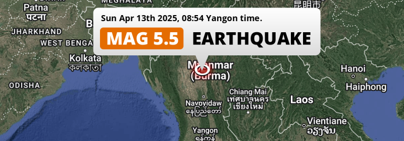
| Date and Time: | Apr 13, 2025 08:54AM (Yangon Time) - Apr 13, 2025 02:24 Universal Time. |
|---|---|
| Location: | 54 mi south of Mandalay, Myanmar. Coordinates 21°11'21"N 96°2'50"E. |
| Map: |  Map of area around epicenter. Click to open in Google Maps. |
| Magnitude: | MAG 5.1 Detected by 23 stations. Maximum Error Range ±0.065 . |
| Depth: | 6 mi (10 km) A very shallow depth. |
| Max. Intensity: | IX
Violent On the Modified Mercalli Scale. |
| Tsunami Risk: | Tsunami very unlikely While this was a shallow earthquake, it appears to have occurred under land with a magnitude not strong enough to cause tsunami's. Always stay cautious - More info here. |
Significant impact predicted
The US Geographic Survey (USGS) describes the impact of this earthquake as follows:
Several homes, buildings and a dam destroyed in the Mandalay-Tatkon area.
Based on scientific estimates by the USGS, the risk of high fatalities for this earthquake is classified at level ORANGE (orange). They expect an 35% likelyhood of between 100 and 1,000 fatalities, and a 93% chance that the number of fatalities falls between 1 and 10,000.
The USGS classifies the economic impact of this earthquake at level ORANGE (orange). They expect an 35% likelyhood of between 100 and 1,000 million US Dollars in economic damage and impact, and a 92% chance that the economic impact of this earthquake falls between 1 and 10,000 million USD.
Roughly 19 million people exposed to shaking
This earthquake may have been felt by around 19 million people. That is the expected population size of the area exposed to a level of shaking of II or higher on the Modified Mercalli scale according to the USGS.
Severe shaking and likely moderate to heavy damage may have been experienced by an estimated 86,360 people. At VIII, it is the highest MMI level this earthquake has caused. Intensity level IV was experienced by the majority of people (around 10 million). In their region, light shaking and likely no damage can be expected.
People in 2 countries have been exposed to shaking. In Myanmar , around 19 million people, with impact levels up to VIII (severe shaking, likely moderate to heavy damage). People were exposed to shaking in Thailand as well.
| People | MMI Level | Shaking | Damage |
|---|---|---|---|
| 0 | I |
Not noticable | None |
| 2,190 | II |
Very weak | None |
| 5,206,000 | III |
Weak | Probably none |
| 9,958,000 | IV |
Light | Likely none |
| 3,348,000 | V |
Moderate | Very light |
| 476,100 | VI |
Strong | Light |
| 155,200 | VII |
Very Strong | Moderate |
| 86,360 | VIII |
Severe | Moderate to heavy |
| 0 | IX |
Violent | Heavy |
| 0 | X |
Extreme | Very heavy |
Nearby towns and cities
This earthquake may have been felt in Myanmar . Meiktila in Mandalay, Myanmar is the nearest significant place from the epicenter. The earthquake occurred 25 miles (40 km) north-northeast of Meiktila. The intensity of shaking and damage in Meiktila is estimated to be around level VI on the Modified Mercalli Intensity scale (strong shaking, probably light damage).
Major cities near this earthquake: Mandalay is located 54 mi to the north and experienced an intensity of V (moderate shaking, very light damage). Nay Pyi Taw is located 100 mi to the south and experienced an intensity of IV (light shaking, likely no damage). Meiktila is located 25 mi to the south-southwest and experienced an intensity of VI (strong shaking, probably light damage).
A complete list of nearby places is included below. Estimated intensity data (MMI) sourced from a shake-map published by the US Geographic Survey is shown where available (cities without data probably experienced little impact).
Overview of nearby places
| Distance | Place | Intensity (MMI) |
|---|---|---|
| 25 mi (40 km) SSW from epicenter |
Meiktila Mandalay, Myanmar. |
VI
Strong |
| 29 mi (47 km) N from epicenter |
Kyaukse Mandalay, Myanmar. |
V
Moderate |
| 47 mi (75 km) WNW from epicenter |
Myingyan Mandalay, Myanmar. |
IV
Light |
| 48 mi (77 km) N from epicenter |
Sagaing Sagain, Myanmar. |
V
Moderate |
| 53 mi (85 km) S from epicenter |
Yamethin Mandalay, Myanmar. |
IV
Light |
| 54 mi (87 km) N from epicenter |
Mandalay Mandalay, Myanmar. |
V
Moderate |
| 63 mi (101 km) W from epicenter |
Pakokku Magway, Myanmar. |
IV
Light |
| 64 mi (103 km) NNE from epicenter |
Pyin Oo Lwin Mandalay, Myanmar. |
IV
Light |
| 70 mi (112 km) ESE from epicenter |
Taunggyi Shan, Myanmar. |
IV
Light |
| 82 mi (132 km) WSW from epicenter |
Chauk Magway, Myanmar. |
IV
Light |
| 86 mi (139 km) NW from epicenter |
Monywa Sagain, Myanmar. |
IV
Light |
| 88 mi (142 km) SSW from epicenter |
Taungdwingyi Magway, Myanmar. |
IV
Light |
| 91 mi (146 km) SW from epicenter |
Yenangyaung Magway, Myanmar. |
IV
Light |
| 98 mi (158 km) NNW from epicenter |
Shwebo Sagain, Myanmar. |
IV
Light |
| 100 mi (161 km) S from epicenter |
Nay Pyi Taw Nay Pyi Taw, Myanmar. |
IV
Light |
| 101 mi (162 km) S from epicenter |
Pyinmana Nay Pyi Taw, Myanmar. |
IV
Light |
| 102 mi (164 km) SW from epicenter |
Magway Magway, Myanmar. |
III
Weak |
| 103 mi (166 km) SW from epicenter |
Minbu Magway, Myanmar. |
III
Weak |
| 123 mi (198 km) NNE from epicenter |
Mogok Mandalay, Myanmar. |
III
Weak |
| 129 mi (207 km) SE from epicenter |
Loikaw Kayah, Myanmar. |
III
Weak |
| 137 mi (220 km) SSW from epicenter |
Myaydo Magway, Myanmar. |
III
Weak |
| 141 mi (227 km) SSW from epicenter |
Thayetmyo Magway, Myanmar. |
|
| 157 mi (253 km) S from epicenter |
Taungoo Bago, Myanmar. |
|
| 163 mi (262 km) NE from epicenter |
Lashio Shan, Myanmar. |
III
Weak |
| 172 mi (277 km) SSW from epicenter |
Pyay Bago, Myanmar. |
|
| 186 mi (299 km) WNW from epicenter |
Hakha Chin, Myanmar. |
Earthquake Intensity Map
The graph below overlays a map of the region around the epicenter with earthquake intensity data provided by the US Geographic Survey. The highest intensity level detected for this earthquake is VIII.

Shaking reported by 19 people in 3 countries
People that feel an earthquake may report their experience to the US Geographic Survey. Currently, 19 people have reported shaking in 9 places in 3 countries (Thailand, India, Myanmar).We keep updating this article as more ground reports become available. You may report that you felt this earthquake here.
Places with most reports:
- Mandalay, Mandalay, Myanmar: 6 people.
- Pyinmana, Mandalay, Myanmar: 3 people.
- Yamethin, Mandalay, Myanmar: 3 people.
- Thanyaburi, Pathum Thani, Thailand: 2 people.
- Phra Pradaeng, Samut Prakan, Thailand: 1 person.
- Mae Sot, Tak, Thailand: 1 person.
- Jaipur, Rajasthan, India: 1 person.
- Mawlamyine, Mon, Myanmar: 1 person.
- Monywa, Sagaing, Myanmar: 1 person.
3 Aftershocks detected
This main shock was followed by 3 smaller aftershocks. At a distance of 57 mi (92 km) north-northeast of this earthquake, an aftershock struck 2 days later. It measured a magnitude of 3.8
This main shock was prefaced by 6 smaller foreshocks. A 4.7 magnitude earthquake hit 2 days earlier nearby.
Overview of foreshocks and aftershocks
| Classification | Magnitude | When | Where |
|---|---|---|---|
| Foreshock | M 3.9 |
2 days earlier Apr 10, 2025 10:47PM (Yangon Time) | 37 mi (60 km) N from Main Shock. |
| Foreshock | M 3.5 |
2 days earlier Apr 11, 2025 08:43AM (Yangon Time) | 50 mi (80 km) SSE from Main Shock. |
| Foreshock | M 4.7 |
2 days earlier Apr 11, 2025 10:59AM (Yangon Time) | 16 mi (26 km) S from Main Shock. |
| Foreshock | M 4.4 |
2 days earlier Apr 11, 2025 11:28AM (Yangon Time) | 12 mi (20 km) S from Main Shock. |
| Foreshock | M 4.2 |
16 hrs earlier Apr 12, 2025 05:03PM (Yangon Time) | 38 mi (62 km) N from Main Shock. |
| Foreshock | M 4.0 |
15 hrs earlier Apr 12, 2025 05:45PM (Yangon Time) | 60 mi (96 km) N from Main Shock. |
| Main Shock This Earthquake |
M 5.1 |
Apr 13, 2025 08:54AM (Yangon Time) | - |
| Aftershock | M 3.5 |
2 days later Apr 15, 2025 01:08AM (Yangon Time) | 45 mi (72 km) NNE from Main Shock. |
| Aftershock | M 3.8 |
2 days later Apr 15, 2025 02:16AM (Yangon Time) | 57 mi (92 km) NNE from Main Shock. |
| Aftershock | M 3.7 |
2 days later Apr 15, 2025 09:35AM (Yangon Time) | 50 mi (81 km) NNE from Main Shock. |
More earthquakes coming?
Earthquakes can create aftershocks. These are generally at least 1 magnitude lower than any main shock, and as time passes the chance and strength of aftershocks decreases.
The chance that a significant earthquake like this one is followed by an even larger earthquake is not so large. On average, scientists estimate a 94% chance that a major earthquake will not be followed by an even larger one. It is still adviced to be aware of this risk
Read: How to Stay Safe during an Earthquake (cdc.gov).Earthquakes like this happen often in the region
Earthquakes of this strength are very common in the region. This is the strongest earthquake to hit since March 28th, 2025, when a 6.7 magnitude earthquake hit 35 mi (57 km) further north. An even stronger magnitude 7.7 earthquake struck on March 28th, 2025.
In total, 13 earthquakes with a magnitude of 5.1 or higher have been registered within 300km (186 mi) of this epicenter in the past 10 years. This comes down to an average of once every 9 months.
Tsunami very unlikely
While MAG-6.5+ earthquakes may cause tsunami's, it appears that the epicenter of this earthquake hit under land. In addition, the reported depth is deeper than 100km, making the risk of a tsunami even less likely. However always stay cautious and monitor advice from local authorities.
Tsunami Risk Factors
| Factor | Under Sea? | MAG-6.5 or stronger? | Shallow depth? |
|---|---|---|---|
| Explanation | Almost all tsunami's are caused by earthquakes with their epicenter under sea or very near the sea. However stay cautious in coastal areas as earthquakes on land may cause landslides into sea, potentially still causing a local tsunami. | Under MAG 6.5: Very unlikely to cause a tsunami. MAG 6.5 to 7.5: Destructive tsunami's do occur, but are uncommon. Likely to observe small sea level changes. MAG 7.6+: Earthquakes with these magnitudes might produce destructive tsunami's. |
Most destructive tsunami's are caused by shallow earthquakes with a depth between 0 and 100km under the surface of the earth. Deeper tsunami's are unlikely to displace to ocean floor. |
| This Earthquake | Not this earthquake. This earthquake appears to have struck on land far from any coast. |
Not this earthquake. This earthquake had a magnitude of 5.1. Earthquakes of this strength are unlikely to trigger a tsunami. |
This earthquake occurred at a depth of of 6 mi (10 km). Earthquakes this shallow could trigger a tsunami. |
Sources
Last updated 11/06/25 06:38 (). This article is automatically generated based on available data. We keep checking multiple sources for additional information. This article gets updated as new details on this earthquake become available.
- US Geographic Society (USGS): Earthquake us6000q5ps
- European-Mediterranean Seismological Centre (EMSC): Earthquake 20250413_0000026
- Geonames.org: World Cities Database
- Google Maps: Static API
- Earthquakelist.org: Historic Earthquakes Database
Share this article:
