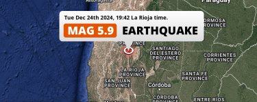
Under land 162 kilometer from San Rafael in Argentina, a significant MAG-5.4 earthquake occurred in the night of Sunday November 3rd, 2024. Roughly 2.3 million people may have felt this earthquake. Another nearby country is Chile.
Felt the earthquake? Share this article:
Earthquake Summary
The earthquake struck on land in Argentina, 162 kilometer (101 mi) southwest of San Rafael in Mendoza. The center of this earthquake had an intermediate depth of 189 km.
Date and Time: | Nov 3, 2024 01:04 (Mendoza Time) - Nov 3, 2024 04:04 Universal Time. |
---|---|
Location: | 270 km SSE of Santiago, Santiago Metropolitan, Chile. Coordinates 35°42'9"S 69°31'2"W. |
Map: | Map of area around epicenter. Click to open in Google Maps. |
Magnitude: | MAG 5.4 Detected by 63 stations. Maximum Error Range ±0.039 . |
Depth: | 189 km (118 mi) An intermediate depth. |
Max. Intensity: | IV
Light On the Modified Mercalli Scale. |
Tsunami Risk: | Tsunami very unlikely Tsunami's are usually caused by MAG-6.5+ earthquakes, less than 100km shallow, and with an epicenter under sea. Neither of this seems to be the case. Always stay cautious - More info here. |
Minimal impact predicted
Based on scientific estimates by the US Geographic Survey (USGS), the risk of high fatalities for this earthquake is classified at level GREEN (low). They expect an 65% likelyhood of between 0 and 1 fatalities, and a 96% chance that the number of fatalities falls no higher than 10.
The USGS classifies the economic impact of this earthquake at level GREEN (low). They expect an 65% likelyhood of between 0 and 1 million US Dollars in economic damage and impact, and a 96% chance that the economic impact of this earthquake falls no higher than 10 million USD.
Roughly 2.3 million people exposed to shaking
This earthquake may have been felt by around 2.3 million people. That is the expected population size of the area exposed to a level of shaking of II or higher on the Modified Mercalli scale according to the USGS.
The highest earthquake impact level for this earthquake is IV, which corresponds with light shaking and likely no damage. Roughly 780 people are expected to be exposed to this level. Intensity level III was experienced by the majority of people (around 2.1 million). In their region, weak shaking and probably no damage can be expected.
People in 2 countries have been exposed to shaking. In Argentina , around 380 thousand people, with impact levels up to IV (light shaking, likely no damage). In Chile , around 1.9 million people.
People | MMI Level | Shaking | Damage |
---|---|---|---|
0 | I |
Not noticable | None |
176,800 | II |
Very weak | None |
2,101,000 | III |
Weak | Probably none |
780 | IV |
Light | Likely none |
0 | V |
Moderate | Very light |
0 | VI |
Strong | Light |
0 | VII |
Very Strong | Moderate |
0 | VIII |
Severe | Moderate to heavy |
0 | IX |
Violent | Heavy |
0 | X |
Extreme | Very heavy |
Nearby towns and cities
Argentina and Chile are both located within 300km distance of the epicenter of the earthquake.
San Rafael in Mendoza, Argentina is the nearest significant place from the epicenter. The earthquake occurred 162 kilometer (101 mi) southwest of San Rafael. The intensity of shaking and damage in San Rafael is estimated to be around level III on the Modified Mercalli Intensity scale (weak shaking, probably no damage).
Major cities near this earthquake: Santiago is located 270 km to the north-northwest (intensity unknown, possibly low). Puente Alto is located 252 km to the north-northwest (intensity unknown, possibly low). Rancagua is located 204 km to the northwest and experienced an intensity of III (weak shaking, probably no damage).
A complete list of nearby places is included below. Estimated intensity data (MMI) sourced from a shake-map published by the US Geographic Survey is shown where available (cities without data probably experienced little impact).
Overview of nearby places
Distance | Place | Intensity (MMI) |
---|---|---|
162 km (101 mi) NE from epicenter |
San Rafael Mendoza, Argentina. |
III
Weak |
173 km (107 mi) WNW from epicenter |
Molina Maule Region, Chile. |
III
Weak |
176 km (109 mi) WNW from epicenter |
Curicó Maule Region, Chile. |
III
Weak |
177 km (110 mi) NW from epicenter |
Chimbarongo O'Higgins Region, Chile. |
III
Weak |
188 km (117 mi) W from epicenter |
Linares Maule Region, Chile. |
III
Weak |
189 km (117 mi) NW from epicenter |
Rengo O'Higgins Region, Chile. |
III
Weak |
196 km (122 mi) W from epicenter |
Talca Maule Region, Chile. |
III
Weak |
198 km (123 mi) NNW from epicenter |
Machalí O'Higgins Region, Chile. |
III
Weak |
200 km (124 mi) W from epicenter |
San Javier Maule Region, Chile. |
III
Weak |
200 km (124 mi) NW from epicenter |
San Vicente de Tagua Tagua O'Higgins Region, Chile. |
III
Weak |
201 km (125 mi) NW from epicenter |
San Vicente O'Higgins Region, Chile. |
III
Weak |
204 km (127 mi) NW from epicenter |
Rancagua O'Higgins Region, Chile. |
III
Weak |
205 km (127 mi) NW from epicenter |
Santa Cruz O'Higgins Region, Chile. |
III
Weak |
213 km (132 mi) NNW from epicenter |
Graneros O'Higgins Region, Chile. |
III
Weak |
214 km (133 mi) WSW from epicenter |
Parral Maule Region, Chile. |
|
234 km (145 mi) WSW from epicenter |
San Carlos Ñuble, Chile. |
|
238 km (148 mi) NNW from epicenter |
Paine Santiago Metropolitan, Chile. |
|
246 km (153 mi) NNW from epicenter |
Buin Santiago Metropolitan, Chile. |
|
252 km (157 mi) NNW from epicenter |
Puente Alto Santiago Metropolitan, Chile. |
|
253 km (157 mi) WSW from epicenter |
Chillán Ñuble, Chile. |
|
255 km (158 mi) W from epicenter |
Cauquenes Maule Region, Chile. |
|
257 km (160 mi) NNW from epicenter |
La Pintana Santiago Metropolitan, Chile. |
|
258 km (160 mi) NNW from epicenter |
San Bernardo Santiago Metropolitan, Chile. |
|
261 km (162 mi) NNW from epicenter |
Talagante Santiago Metropolitan, Chile. |
|
262 km (163 mi) NNW from epicenter |
El Monte Santiago Metropolitan, Chile. |
|
264 km (164 mi) NNW from epicenter |
Peñaflor Santiago Metropolitan, Chile. |
|
265 km (165 mi) W from epicenter |
Constitución Maule Region, Chile. |
|
270 km (168 mi) NNW from epicenter |
Santiago Santiago Metropolitan, Chile. |
|
272 km (169 mi) NW from epicenter |
Melipilla Santiago Metropolitan, Chile. |
|
274 km (170 mi) NNW from epicenter |
Lo Prado Santiago Metropolitan, Chile. |
|
286 km (178 mi) SSE from epicenter |
Catriel Rio Negro, Argentina. |
|
288 km (179 mi) NNW from epicenter |
Chicureo Abajo Santiago Metropolitan, Chile. |
|
296 km (184 mi) NNW from epicenter |
Lampa Santiago Metropolitan, Chile. |
|
298 km (185 mi) WSW from epicenter |
Cabrero Biobío, Chile. |
Earthquake Intensity Map
The intensity in shaking and damage by this earthquake is illustrated through the map below. The highest intensity measured for this earthquake is IV.
Shaking reported by 22 people in 2 countries
People that feel an earthquake may report their experience to the US Geographic Survey. Currently, 22 people have reported shaking in 11 places in 2 countries (Argentina, Chile).We keep updating this article as more ground reports become available. You may report that you felt this earthquake here.
Places with most reports:
- Santiago, Metropolitana, Chile: 8 people.
- Puente Alto, Metropolitana, Chile: 3 people.
- Viña del Mar, Valparaíso, Chile: 3 people.
- San Rafael, Mendoza, Argentina: 1 person.
- Arauco, Bío Bío, Chile: 1 person.
- Rancagua, Libertador General Bernardo OʿHiggins, Chile: 1 person.
- Talca, Maule, Chile: 1 person.
- Peñaflor, Metropolitana, Chile: 1 person.
- San Bernardo, Metropolitana, Chile: 1 person.
- Calera, Valparaíso, Chile: 1 person.
Risk of aftershocks?
This earthquake did not have any significant foreshocks nor aftershocks occurring within 100km (62 mi) of its epicenter.
Earthquakes can create aftershocks. These are generally at least 1 magnitude lower than any main shock, and as time passes the chance and strength of aftershocks decreases.
It's always adviced to be cautious of the risk of a larger shock following any significant earthquake, however this risk is fairly small. There is a roughly 94 percent change that no larger main shock will follow in the days following this earthquake.
Read: How to Stay Safe during an Earthquake (cdc.gov).Earthquakes like this happen often in the region
Earthquakes of this strength are very common in the region. This is the strongest earthquake to hit since July 17th, 2023, when a 6.6 magnitude earthquake hit 288 km (179 mi) further south-southwest. That was also the heaviest earthquake to hit the region in the past 10 years.
In total, 14 earthquakes with a magnitude of 5.4 or higher have been registered within 300km (186 mi) of this epicenter in the past 10 years. This comes down to an average of once every 9 months.
Tsunami very unlikely
It is very unlikely that this eartquake will cause any tsunami's. The reported magnitude is lower than the MAG-6.5 strength required to cause any earthquakes. In addition, this earthquake was not very shallow and appears to have occurred under land. However always stay cautious and monitor advice from local authorities.
Tsunami Risk Factors
Factor | Under Sea? | MAG-6.5 or stronger? | Shallow depth? |
---|---|---|---|
Explanation | Almost all tsunami's are caused by earthquakes with their epicenter under sea or very near the sea. However stay cautious in coastal areas as earthquakes on land may cause landslides into sea, potentially still causing a local tsunami. | Under MAG 6.5: Very unlikely to cause a tsunami. MAG 6.5 to 7.5: Destructive tsunami's do occur, but are uncommon. Likely to observe small sea level changes. MAG 7.6+: Earthquakes with these magnitudes might produce destructive tsunami's. |
Most destructive tsunami's are caused by shallow earthquakes with a depth between 0 and 100km under the surface of the earth. Deeper tsunami's are unlikely to displace to ocean floor. |
This Earthquake | Not this earthquake. This earthquake appears to have struck on land far from any coast. |
Not this earthquake. This earthquake had a magnitude of 5.4. Earthquakes of this strength are unlikely to trigger a tsunami. |
Not this earthquake. This earthquake occurred at a depth of 189 km (118 mi). Earthquakes this deep in the earth are unlikely to trigger a tsunami. |
Sources
Last updated 07/11/24 03:08 (). As more information on this earthquake becomes available this article will be updated. This article is automatically composed based on data originating from multiple sources.