Latest earthquakes near New Zealand today
Complete overview of the latest earthquakes near the country New Zealand, updated every minute. Did you feel an earthquake today in New Zealand? If an earthquake is happening right now near New Zealand (also known as Aotearoa), it will show up within minutes.
| Date and Time | Magnitude | Location |
|---|---|---|
| 5 hours ago (Apr 17 05:11 Auckland) |
M 3.5 | 35 km NNW from Gisborne |
| 19 hours ago (Apr 16 15:19 Auckland) |
M 3.5 | 83 km SSE from Nelson |
| 1 day ago (Apr 16 07:56 Auckland) |
M 3.3 | 151 km NNW from Invercargill |
| 1 day ago (Apr 16 07:20 Auckland) |
M 4.0 | 27 km SSE from Gisborne |
| 1 day ago (Apr 16 04:07 Auckland) |
M 3.0 | 36 km NNW from Gisborne |
| 1 day ago (Apr 15 19:55 Auckland) |
M 3.1 | 224 km W from Invercargill |
| 1 day ago (Apr 15 11:24 Auckland) |
M 3.0 | 151 km NW from Wellington |
| 2 days ago (Apr 15 07:15 Auckland) |
M 3.5 | 35 km NNW from Gisborne |
| 2 days ago (Apr 14 16:05 Auckland) |
M 4.2 | 131 km NNW from Wellington |
| 2 days ago (Apr 14 11:34 Auckland) |
M 3.2 | 187 km NE from Gisborne |
| 3 days ago (Apr 14 02:51 Auckland) |
M 3.1 | 295 km E from Auckland |
| 3 days ago (Apr 13 15:55 Auckland) |
M 3.0 | 201 km NW from Wellington |
| 4 days ago (Apr 13 08:53 Auckland) |
M 3.3 | 70 km NE from Hastings |
| 4 days ago (Apr 13 08:06 Auckland) |
M 3.1 | 151 km WNW from Christchurch |
| 4 days ago (Apr 13 06:41 Auckland) |
M 3.3 | 179 km NNE from Gisborne |
| 5 days ago (Apr 12 06:23 Auckland) |
M 3.4 | 296 km ENE from Auckland |
| 6 days ago (Apr 11 09:12 Auckland) |
M 3.2 | 46 km N from Gisborne |
| 6 days ago (Apr 11 09:10 Auckland) |
M 3.3 | 46 km N from Gisborne |
| 6 days ago (Apr 11 07:26 Auckland) |
M 3.2 | 210 km W from Invercargill |
| 6 days ago (Apr 11 03:52 Auckland) |
M 3.0 | 42 km NW from Wellington |
| 6 days ago (Apr 10 21:31 Auckland) |
M 3.0 | 52 km SW from Wellington |
| 6 days ago (Apr 10 21:30 Auckland) |
M 3.3 | 51 km SW from Wellington |
| 6 days ago (Apr 10 21:22 Auckland) |
M 3.9 | 52 km SW from Wellington |
| 6 days ago (Apr 10 20:52 Auckland) |
M 3.1 | 51 km SW from Wellington |
| 7 days ago (Apr 10 07:03 Auckland) |
M 3.6 | 198 km W from Invercargill |
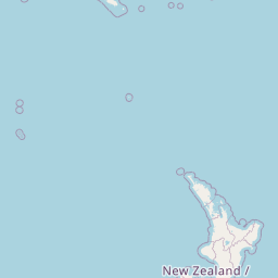
Map of Latest Earthquakes near New Zealand


Recent New Zealand Earthquake News
These are the latest articles published related to earthquakes occurring near New Zealand. Check our Earthquake News section for a complete overview of articles written on earthquakes near New Zealand and elsewhere.
 Mar 25, 2025 03:56PM
Shallow M5.4 AFTERSHOCK struck on Tuesday Afternoon in the Tasman Sea 201km from Invercargill (New Zealand).
Mar 25, 2025 03:56PM
Shallow M5.4 AFTERSHOCK struck on Tuesday Afternoon in the Tasman Sea 201km from Invercargill (New Zealand).
 Mar 25, 2025 02:43PM
Unusually powerful M6.7 Earthquake struck on Tuesday Afternoon in the Tasman Sea 194km from Invercargill (New Zealand).
Mar 25, 2025 02:43PM
Unusually powerful M6.7 Earthquake struck on Tuesday Afternoon in the Tasman Sea 194km from Invercargill (New Zealand).
New Zealand Earthquake Statistics
Average
A total of 2295 earthquakes with a magnitude of four or above have struck within 300 km (186 mi) of New Zealand in the past 10 years. This comes down to a yearly average of 229 earthquakes per year, or 19 per month. On average an earthquake will hit near New Zealand roughly every 1 days.
A relatively large number of earthquakes occurred near New Zealand in 2016. A total of 676 earthquakes (mag 4+) were detected within 300 km of New Zealand that year. The strongest had a 7.8 magnitude.

Magnitude Distribution
The table below visualizes the distribution of all earthquakes that occurred within 300km of New Zealand in the past 10 years. No earthquakes with a magnitude of 8 or above have occurred near New Zealand during this time. Usually, higher magnitudes are less common than lower magnitudes. Small earthquakes with a magnitude below 4 on the Richter scale have been omitted from this overview.
| Magnitude | Earthquakes | Percentage |
|---|---|---|
| Mag. 4 | 2089 | 91.02% |
| Mag. 5 | 192 | 8.37% |
| Mag. 6 | 11 | 0.48% |
| Mag. 7 | 3 | 0.13% |
| Mag. 8 | 0 | 0.0% |
| Mag. 9 | 0 | 0.0% |
| Mag. 10 | 0 | 0.0% |
Strongest earthquakes near New Zealand
The strongest recent earthquake of the past 10 years near New Zealand occurred on Nov 14, 2016 00:02 local time (Pacific/Auckland timezone). It had a magnitude of 7.8 and struck 95 kilometers (59 mi) north-northeast of Christchurch, at a depth of 15 km. Discover more strong earthquakes near New Zealand in the list below.
In the table below you will find the strongest earthquakes that occurred near New Zealand in the past 10 years. You can use the tabs to find the heaviest historic earthquakes since the year 1900 or within a specific year or distance from New Zealand.
| Date and Time | Magnitude | Location |
|---|---|---|
| Nov 14, 2016 00:02 (Auckland) |
M 7.8 | 95 km NNE from Christchurch |
| Mar 5, 2021 02:27 (Auckland) |
M 7.3 | 182 km NE from Gisborne |
| Sep 2, 2016 04:37 (Auckland) |
M 7.0 | 175 km NE from Gisborne |
| 22 days ago (Mar 25 14:43 Auckland) |
M 6.7 | 194 km W from Invercargill |
| Nov 14, 2016 00:32 (Auckland) |
M 6.5 | 147 km SW from Wellington |
| Nov 14, 2016 13:34 (Auckland) |
M 6.5 | 115 km NNE from Christchurch |
| Mar 6, 2021 13:16 (Auckland) |
M 6.3 | 184 km NE from Gisborne |
| Nov 14, 2016 02:31 (Auckland) |
M 6.2 | 145 km SW from Wellington |
| Sep 2, 2016 05:14 (Auckland) |
M 6.1 | 196 km NNE from Gisborne |
| Nov 14, 2016 00:52 (Auckland) |
M 6.1 | 138 km SW from Wellington |
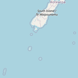
Map of Strongest Earthquakes near New Zealand
Earthquakes by region of New Zealand
Click the links below for earthquake reports for regions in New Zealand.
- Auckland
- Bay of Plenty
- Canterbury
- Gisborne
- Hawke's Bay
- Manawatu-Wanganui
- Marlborough
- Nelson
- Northland
- Otago
- Southland
- Taranaki
- Waikato
- Wellington
Frequently Asked Questions
These questions are commonly asked in relation to earthquakes occurring near New Zealand.
When was the last earthquake in New Zealand?
A 3.5 magnitude earthquake hit near New Zealand on the night of April 17, 2025 at 05:11 local time (Pacific/Auckland). The center of this earthquake was located 35km north-northwest of Gisborne at a depth of 25km under land. Check the list on our website for any earthquakes occurring near New Zealand in the past hours.
What was the strongest earthquake near New Zealand?
A 7.8 magnitude earthquake hit near New Zealand on the night of November 14, 2016 at 00:02 local time (Pacific/Auckland). The center of this earthquake was located 95km north-northeast of Christchurch at a depth of 15km under land. This is the strongest earthquake that occurred near New Zealand since the year 1900.
How often do earthquakes occur near New Zealand?
In the past 10 years, 2295 earthquakes with a magnitude of four or higher occurred within a 300 kilometer range from New Zealand. This averages to 230 earthquakes yearly, or one earthquake every 2 days.
