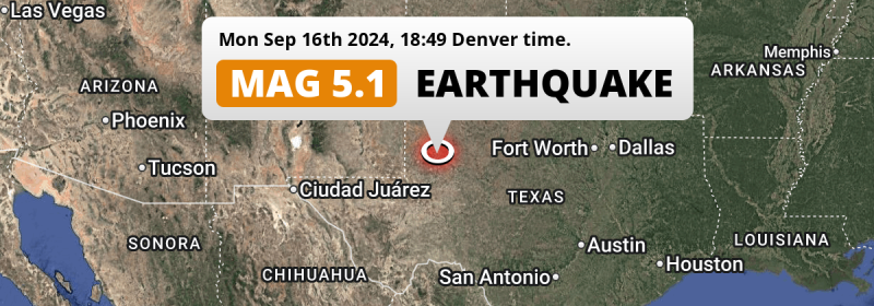
In the evening of Monday September 16th, 2024, a shallow and significant Magnitude 5.1 earthquake hit under land 29 miles from Midland in The United States. Shaking may have been felt by a total of 1.2 million people.
Felt the earthquake? Share this article: 


Earthquake Summary
The earthquake struck on land in The United States, 29 miles (46 km) north of Midland in Texas. The center of this earthquake had a very shallow depth of 4 km. Shallow earthquakes usually have a larger impact than earthquakes deep in the earth.
| Date and Time: | Sep 16, 2024 07:49PM (Chicago Time) - Sep 17, 2024 00:49 Universal Time. |
|---|---|
| Location: | 29 mi north of Midland, Texas, The United States. Coordinates 32°24'40"N 102°3'25"W. |
| Map: | 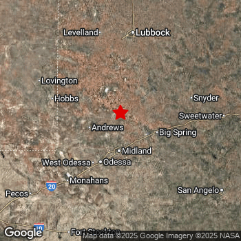 Map of area around epicenter. Click to open in Google Maps. |
| Magnitude: | MAG 5.1 Detected by 35 stations. Maximum Error Range ±0.052 . |
| Depth: | 4 mi (6 km) A very shallow depth. |
| Max. Intensity: | VI
Strong On the Modified Mercalli Scale. |
| Tsunami Risk: | Tsunami very unlikely While this was a shallow earthquake, it appears to have occurred under land with a magnitude not strong enough to cause tsunami's. Always stay cautious - More info here. |
Minimal impact predicted
Based on scientific estimates by the US Geographic Survey (USGS), the risk of high fatalities for this earthquake is classified at level GREEN (low). They expect an 65% likelyhood of between 0 and 1 fatalities, and a 96% chance that the number of fatalities falls no higher than 10.
The USGS classifies the economic impact of this earthquake at level GREEN (low). They expect an 65% likelyhood of between 0 and 1 million US Dollars in economic damage and impact, and a 96% chance that the economic impact of this earthquake falls no higher than 10 million USD.
Roughly 1.2 million people exposed to shaking
This earthquake may have been felt by around 1.2 million people. That is the expected population size of the area exposed to a level of shaking of II or higher on the Modified Mercalli scale according to the USGS.
Moderate shaking and very light damage may have been experienced by an estimated 6,450 people. At V, it is the highest MMI level this earthquake has caused. The majority of people (roughly 0.8 million) live in an area exposed to level III, where weak shaking and probably no damage is expected.
| People | MMI Level | Shaking | Damage |
|---|---|---|---|
| 0 | I |
Not noticable | None |
| 0 | II |
Very weak | None |
| 810,200 | III |
Weak | Probably none |
| 423,900 | IV |
Light | Likely none |
| 6,450 | V |
Moderate | Very light |
| 0 | VI |
Strong | Light |
| 0 | VII |
Very Strong | Moderate |
| 0 | VIII |
Severe | Moderate to heavy |
| 0 | IX |
Violent | Heavy |
| 0 | X |
Extreme | Very heavy |
Nearby towns and cities
This earthquake may have been felt in The United States . The closest significant population center near the earthquake is Midland in Texas, The United States. Midland is located 29 miles (46 km) north of the epicenter. The intensity of shaking and damage in Midland is estimated to be around level III on the Modified Mercalli Intensity scale (weak shaking, probably no damage).
Multiple major population centers exist within 300km of the earthquake that struck today. Midland is located 29 mi to the south and experienced an intensity of III (weak shaking, probably no damage). Lubbock is located 81 mi to the north and experienced an intensity of III (weak shaking, probably no damage). Odessa is located 43 mi to the south-southwest and experienced an intensity of IV (light shaking, likely no damage).
The table below provides an overview of all places in proximity of today's earthquake. Where available, the estimated intensity on the Modified Mercalli Intensity Scale in each place is included. Places where this information is omitted likely experienced little impact.
Overview of nearby places
| Distance | Place | Intensity (MMI) |
|---|---|---|
| 29 mi (46 km) S from epicenter |
Midland Texas, The United States. |
III
Weak |
| 35 mi (57 km) ESE from epicenter |
Big Spring Texas, The United States. |
IV
Light |
| 43 mi (69 km) SSW from epicenter |
Odessa Texas, The United States. |
IV
Light |
| 47 mi (76 km) SSW from epicenter |
West Odessa Texas, The United States. |
IV
Light |
| 66 mi (106 km) WNW from epicenter |
Hobbs New Mexico, The United States. |
III
Weak |
| 81 mi (131 km) N from epicenter |
Lubbock Texas, The United States. |
III
Weak |
| 116 mi (186 km) SE from epicenter |
San Angelo Texas, The United States. |
III
Weak |
| 124 mi (200 km) N from epicenter |
Plainview Texas, The United States. |
|
| 127 mi (204 km) W from epicenter |
Carlsbad New Mexico, The United States. |
|
| 135 mi (218 km) E from epicenter |
Abilene Texas, The United States. |
|
| 153 mi (246 km) NNW from epicenter |
Clovis New Mexico, The United States. |
|
| 158 mi (255 km) WNW from epicenter |
Roswell New Mexico, The United States. |
|
| 167 mi (269 km) N from epicenter |
Hereford Texas, The United States. |
|
| 186 mi (299 km) ESE from epicenter |
Brownwood Texas, The United States. |
Earthquake Intensity Map
The intensity in shaking and damage by this earthquake is illustrated through the map below. The highest intensity measured for this earthquake is V.

Aftershocks detected
After this earthquake struck, 1 smaller aftershock occurred. A 2.9 magnitude earthquake hit 5 hrs later 0.8 mi (1.3 km) east-southeast of this earthquake.
Overview of foreshocks and aftershocks
| Classification | Magnitude | When | Where |
|---|---|---|---|
| Main Shock This Earthquake |
M 5.1 |
Sep 16, 2024 07:49PM (Chicago Time) | - |
| Aftershock | M 2.9 |
5 hrs later Sep 17, 2024 12:46AM (Chicago Time) | 0.8 mi (1.3 km) ESE from Main Shock. |
More earthquakes coming?
Earthquakes can create aftershocks. These are generally at least 1 magnitude lower than any main shock, and as time passes the chance and strength of aftershocks decreases.
In only six percent of cases, significant earthquakes are followed by a larger main shock, making the current earthquake a foreshock. While the chance of this happening is not so large, it is adviced to maintain cautiousness in the hours and days following a major earthquake.
Read: How to Stay Safe during an Earthquake (cdc.gov).Earthquakes like this are common in the region
Earthquakes of this strength occur quite regularly in the region. This is the strongest earthquake to hit since November 8th, 2023, when a 5.2 magnitude earthquake hit 125 mi (202 km) further west-southwest. An even stronger magnitude 5.4 earthquake struck on November 16th, 2022.
In total, 3 earthquakes with a magnitude of 5.1 or higher have been registered within 300km (186 mi) of this epicenter in the past 10 years. This comes down to an average of once every 3 years.
Tsunami very unlikely
While MAG-6.5+ earthquakes may cause tsunami's, it appears that the epicenter of this earthquake hit under land. In addition, the reported depth is deeper than 100km, making the risk of a tsunami even less likely. However always stay cautious and monitor advice from local authorities.
Tsunami Risk Factors
| Factor | Under Sea? | MAG-6.5 or stronger? | Shallow depth? |
|---|---|---|---|
| Explanation | Almost all tsunami's are caused by earthquakes with their epicenter under sea or very near the sea. However stay cautious in coastal areas as earthquakes on land may cause landslides into sea, potentially still causing a local tsunami. | Under MAG 6.5: Very unlikely to cause a tsunami. MAG 6.5 to 7.5: Destructive tsunami's do occur, but are uncommon. Likely to observe small sea level changes. MAG 7.6+: Earthquakes with these magnitudes might produce destructive tsunami's. |
Most destructive tsunami's are caused by shallow earthquakes with a depth between 0 and 100km under the surface of the earth. Deeper tsunami's are unlikely to displace to ocean floor. |
| This Earthquake | Not this earthquake. This earthquake appears to have struck on land far from any coast. |
Not this earthquake. This earthquake had a magnitude of 5.1. Earthquakes of this strength are unlikely to trigger a tsunami. |
This earthquake occurred at a depth of of 4 mi (6 km). Earthquakes this shallow could trigger a tsunami. |
Sources
Last updated 15/11/24 08:38 (). This article is automatically generated based on available data. We keep checking multiple sources for additional information. This article gets updated as new details on this earthquake become available.
- US Geographic Society (USGS): Earthquake tx2024shcj
- European-Mediterranean Seismological Centre (EMSC): Earthquake 20240917_0000012
- Geonames.org: World Cities Database
- Google Maps: Static API
- Earthquakelist.org: Historic Earthquakes Database
Share this article:
