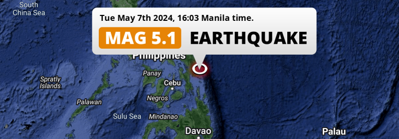
In the Philippine Sea 76 kilometer from Tacloban, The Philippines, a significant M5.1 earthquake occurred in the late afternoon of Tuesday May 7th, 2024.
Felt the earthquake? Share this article: 


Earthquake Summary
This earthquake hit under water in the Philippine Sea, right off the coast of The Philippines (4 mi offshore), 76 kilometer east of Tacloban in Eastern Visayas. The center of this earthquake had a quite shallow depth of 62 km. Shallow earthquakes usually have a larger impact than earthquakes deep in the earth.
| Date and Time: | May 7, 2024 04:03PM (Manila Time) - May 7, 2024 08:03 Universal Time. |
|---|---|
| Location: | 76 km east of Tacloban, Eastern Visayas, The Philippines. Coordinates 11°19'14"N 125°41'56"E. |
| Map: | 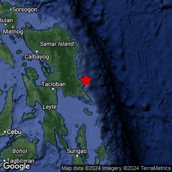 Map of area around epicenter. Click to open in Google Maps. |
| Magnitude: | MAG 5.1 Detected by 118 stations. Maximum Error Range ±0.052 . |
| Depth: | 62 km (39 mi) A quite shallow depth. |
| Tsunami Risk: | Low tsunami risk Earthquakes under MAG-6.5 do not usually cause tsunami's. Always stay cautious - More info here. |
Nearby towns and cities
This earthquake may have been felt in The Philippines . The closest significant population center near the earthquake is Borongan in Eastern Visayas, The Philippines. Borongan is located 43 kilometer (27 mi) south-east of the epicenter.
Multiple large cities are in proximity of today's earthquake. Cebu City is located 227 km to the west-southwest. Tacloban is located 76 km to the west. Panalanoy is located 76 km to the west.
An overview of nearby towns and cities is available in the overview below.
Overview of nearby places
| Distance | Place |
|---|---|
| 43 km (27 mi) NW from epicenter |
Borongan Eastern Visayas, The Philippines. |
| 76 km (47 mi) W from epicenter |
Tacloban Eastern Visayas, The Philippines. |
| 76 km (47 mi) W from epicenter |
Panalanoy Eastern Visayas, The Philippines. |
| 78 km (48 mi) WSW from epicenter |
Tanauan Eastern Visayas, The Philippines. |
| 79 km (49 mi) WSW from epicenter |
Palo Eastern Visayas, The Philippines. |
| 99 km (62 mi) SW from epicenter |
Abuyog Eastern Visayas, The Philippines. |
| 102 km (63 mi) WNW from epicenter |
Catbalogan Eastern Visayas, The Philippines. |
| 111 km (69 mi) W from epicenter |
Carigara Eastern Visayas, The Philippines. |
| 121 km (75 mi) SW from epicenter |
Baybay Eastern Visayas, The Philippines. |
| 124 km (77 mi) WSW from epicenter |
Ormoc Eastern Visayas, The Philippines. |
| 146 km (91 mi) NW from epicenter |
Calbayog City Eastern Visayas, The Philippines. |
| 158 km (98 mi) NNW from epicenter |
Laoang Eastern Visayas, The Philippines. |
| 162 km (101 mi) SW from epicenter |
Maasin Eastern Visayas, The Philippines. |
| 172 km (107 mi) S from epicenter |
Surigao Caraga, The Philippines. |
| 175 km (109 mi) NW from epicenter |
Catarman Eastern Visayas, The Philippines. |
| 187 km (116 mi) W from epicenter |
Bogo Central Visayas, The Philippines. |
| 201 km (125 mi) WSW from epicenter |
Cogan Central Visayas, The Philippines. |
| 203 km (126 mi) WSW from epicenter |
Danao Central Visayas, The Philippines. |
| 208 km (129 mi) WSW from epicenter |
Compostela Central Visayas, The Philippines. |
| 212 km (132 mi) WSW from epicenter |
Liloan Central Visayas, The Philippines. |
| 217 km (135 mi) WSW from epicenter |
Consolacion Central Visayas, The Philippines. |
| 222 km (138 mi) WSW from epicenter |
Lapu-Lapu City Central Visayas, The Philippines. |
| 223 km (139 mi) WSW from epicenter |
Mandaue City Central Visayas, The Philippines. |
| 224 km (139 mi) WSW from epicenter |
Apas Central Visayas, The Philippines. |
| 226 km (140 mi) WSW from epicenter |
Cordova Central Visayas, The Philippines. |
| 227 km (141 mi) WSW from epicenter |
Cebu City Central Visayas, The Philippines. |
| 235 km (146 mi) WSW from epicenter |
Talisay Central Visayas, The Philippines. |
| 236 km (147 mi) SW from epicenter |
Jagna Central Visayas, The Philippines. |
| 240 km (149 mi) WSW from epicenter |
Minglanilla Central Visayas, The Philippines. |
| 245 km (152 mi) WSW from epicenter |
Naga Central Visayas, The Philippines. |
| 245 km (152 mi) S from epicenter |
Cabadbaran Caraga, The Philippines. |
| 246 km (153 mi) WSW from epicenter |
Escalante Western Visayas, The Philippines. |
| 248 km (154 mi) WSW from epicenter |
Toledo Central Visayas, The Philippines. |
| 249 km (155 mi) NW from epicenter |
Bulan Bicol, The Philippines. |
| 252 km (157 mi) W from epicenter |
Sagay Western Visayas, The Philippines. |
| 254 km (158 mi) WNW from epicenter |
Masbate Bicol, The Philippines. |
| 255 km (158 mi) SSE from epicenter |
Tandag Caraga, The Philippines. |
| 259 km (161 mi) W from epicenter |
Paraiso Western Visayas, The Philippines. |
| 261 km (162 mi) NW from epicenter |
Sorsogon Bicol, The Philippines. |
| 262 km (163 mi) WSW from epicenter |
Carcar Central Visayas, The Philippines. |
| 263 km (163 mi) S from epicenter |
Buenavista Caraga, The Philippines. |
| 264 km (164 mi) S from epicenter |
Butuan Caraga, The Philippines. |
| 265 km (165 mi) S from epicenter |
Libertad Caraga, The Philippines. |
| 265 km (165 mi) WSW from epicenter |
Ualog Western Visayas, The Philippines. |
| 266 km (165 mi) W from epicenter |
Cadiz Western Visayas, The Philippines. |
| 274 km (170 mi) SW from epicenter |
Tagbilaran City Central Visayas, The Philippines. |
| 284 km (176 mi) SSW from epicenter |
Mariano Northern Mindanao, The Philippines. |
| 285 km (177 mi) S from epicenter |
Bayugan Caraga, The Philippines. |
| 290 km (180 mi) WSW from epicenter |
Canlaon Central Visayas, The Philippines. |
| 291 km (181 mi) W from epicenter |
Victorias Western Visayas, The Philippines. |
| 294 km (183 mi) NW from epicenter |
Legaspi Bicol, The Philippines. |
Shaking reported by 1 person
People that feel an earthquake may report their experience to the US Geographic Survey. Currently, 1 person has reported shaking in one place in Philippines.We keep updating this article as more ground reports become available. You may report that you felt this earthquake here.
Places with most reports:
- Hernani, Eastern Visayas, Philippines: 1 person.
10 Aftershocks detected
This main shock was followed by 10 smaller aftershocks. A 3.9 magnitude earthquake hit 1 day later 75 km (46 mi) southwest of this earthquake.
This main shock was prefaced by 12 smaller foreshocks. Nearby this earthquake a foreshock struck 2 days earlier. It measured a magnitude of 4.3
Overview of foreshocks and aftershocks
| Classification | Magnitude | When | Where |
|---|---|---|---|
| Foreshock | M 3.1 |
3 days earlier May 4, 2024 09:20PM (Manila Time) | 68 km (42 mi) SSW from Main Shock. |
| Foreshock | M 4.3 |
2 days earlier May 5, 2024 06:09AM (Manila Time) | 74 km (46 mi) SSW from Main Shock. |
| Foreshock | M 3.0 |
2 days earlier May 5, 2024 05:43PM (Manila Time) | 76 km (47 mi) SSW from Main Shock. |
| Foreshock | M 3.2 |
2 days earlier May 5, 2024 05:52PM (Manila Time) | 69 km (43 mi) SW from Main Shock. |
| Foreshock | M 3.8 |
2 days earlier May 5, 2024 06:05PM (Manila Time) | 70 km (44 mi) SW from Main Shock. |
| Foreshock | M 3.3 |
2 days earlier May 5, 2024 11:20PM (Manila Time) | 66 km (41 mi) SW from Main Shock. |
| Foreshock | M 3.0 |
2 days earlier May 5, 2024 11:31PM (Manila Time) | 88 km (55 mi) NE from Main Shock. |
| Foreshock | M 3.3 |
2 days earlier May 6, 2024 12:34AM (Manila Time) | 69 km (43 mi) SSW from Main Shock. |
| Foreshock | M 3.0 |
2 days earlier May 6, 2024 02:14AM (Manila Time) | 67 km (42 mi) SSW from Main Shock. |
| Foreshock | M 3.1 |
1 day earlier May 6, 2024 04:36AM (Manila Time) | 64 km (40 mi) SSW from Main Shock. |
| Foreshock | M 3.0 |
21 hrs earlier May 6, 2024 06:54PM (Manila Time) | 72 km (45 mi) SW from Main Shock. |
| Foreshock | M 3.7 |
15 hrs earlier May 7, 2024 12:36AM (Manila Time) | 69 km (43 mi) SW from Main Shock. |
| Main Shock This Earthquake |
M 5.1 |
May 7, 2024 04:03PM (Manila Time) | - |
| Aftershock | M 3.4 |
4 hrs later May 7, 2024 08:16PM (Manila Time) | 91 km (57 mi) SW from Main Shock. |
| Aftershock | M 3.0 |
5 hrs later May 7, 2024 08:44PM (Manila Time) | 51 km (32 mi) SSW from Main Shock. |
| Aftershock | M 3.3 |
5 hrs later May 7, 2024 08:51PM (Manila Time) | 72 km (45 mi) SW from Main Shock. |
| Aftershock | M 3.1 |
5 hrs later May 7, 2024 08:57PM (Manila Time) | 69 km (43 mi) SSW from Main Shock. |
| Aftershock | M 3.4 |
6 hrs later May 7, 2024 10:14PM (Manila Time) | 43 km (27 mi) NNE from Main Shock. |
| Aftershock | M 3.5 |
8 hrs later May 7, 2024 11:53PM (Manila Time) | 67 km (42 mi) SW from Main Shock. |
| Aftershock | M 3.3 |
12 hrs later May 8, 2024 04:31AM (Manila Time) | 71 km (44 mi) SW from Main Shock. |
| Aftershock | M 3.9 |
1 day later May 8, 2024 08:24PM (Manila Time) | 75 km (46 mi) SW from Main Shock. |
| Aftershock | M 3.3 |
1 day later May 8, 2024 10:09PM (Manila Time) | 64 km (40 mi) SW from Main Shock. |
| Aftershock | M 3.3 |
2 days later May 9, 2024 11:25AM (Manila Time) | 63 km (39 mi) SSW from Main Shock. |
More earthquakes coming?
Earthquakes can create aftershocks. These are generally at least 1 magnitude lower than any main shock, and as time passes the chance and strength of aftershocks decreases.
It's always adviced to be cautious of the risk of a larger shock following any significant earthquake, however this risk is fairly small. There is a roughly 94 percent change that no larger main shock will follow in the days following this earthquake.
Read: How to Stay Safe during an Earthquake (cdc.gov).Earthquakes like this happen often in the region
Earthquakes of this strength are very common in the region. This is the strongest earthquake to hit since May 3rd, 2024, when a 5.7 magnitude earthquake hit 67 km (42 mi) further southwest. An even stronger magnitude 6.9 earthquake struck on December 3rd, 2023.
In total, 92 earthquakes with a magnitude of 5.1 or higher have been registered within 300km (186 mi) of this epicenter in the past 10 years. This comes down to an average of once every month.
Low tsunami risk
Based on early data it appears this earthquake was not strong enough (lower than MAG-6.5) to be likely to cause destructive tsunami's. However this earthquake appeared to have hit at a shallow depth under sea, so stay cautious and monitor advice from local authorities.
Tsunami Risk Factors
| Factor | Under Sea? | MAG-6.5 or stronger? | Shallow depth? |
|---|---|---|---|
| Explanation | Almost all tsunami's are caused by earthquakes with their epicenter under sea or very near the sea. However stay cautious in coastal areas as earthquakes on land may cause landslides into sea, potentially still causing a local tsunami. | Under MAG 6.5: Very unlikely to cause a tsunami. MAG 6.5 to 7.5: Destructive tsunami's do occur, but are uncommon. Likely to observe small sea level changes. MAG 7.6+: Earthquakes with these magnitudes might produce destructive tsunami's. |
Most destructive tsunami's are caused by shallow earthquakes with a depth between 0 and 100km under the surface of the earth. Deeper tsunami's are unlikely to displace to ocean floor. |
| This Earthquake | This earthquake appears to have struck under the sea. | Not this earthquake. This earthquake had a magnitude of 5.1. Earthquakes of this strength are unlikely to trigger a tsunami. |
This earthquake occurred at a depth of of 62 km (39 mi). Earthquakes this shallow could trigger a tsunami. |
Sources
Last updated 19/05/24 09:18 (). This article contains currently available information about the earthquake and is automatically composed. We continue to update this article up to a few days after the earthquake occurred.
- US Geographic Society (USGS): Earthquake us6000mwwl
- European-Mediterranean Seismological Centre (EMSC): Earthquake 20240507_0000072
- Geonames.org: World Cities Database
- Google Maps: Static API
- Earthquakelist.org: Historic Earthquakes Database
Share this article:
