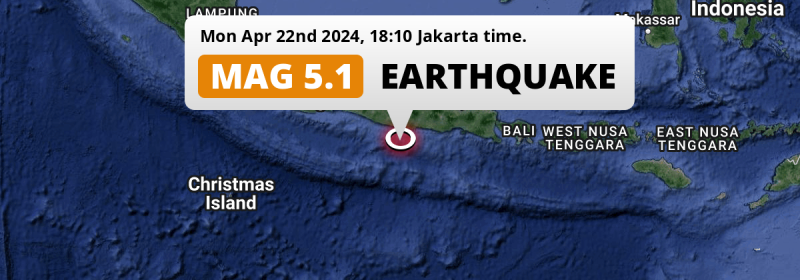
A significant M5.1 earthquake struck in the Indian Ocean 164 kilometer from Yogyakarta, Indonesia in the evening of Monday April 22nd, 2024.
Felt the earthquake? Share this article: 


Earthquake Summary
This earthquake hit under water in the Indian Ocean, 74 kilometers (46 mi) off the coast of Indonesia, 164 kilometer south-east of Yogyakarta. The center of this earthquake had a quite shallow depth of 54 km. Shallow earthquakes usually have a larger impact than earthquakes deep in the earth.
| Date and Time: | Apr 22, 2024 18:10 (Jakarta Time) - Apr 22, 2024 11:10 Universal Time. |
|---|---|
| Location: | 164 km SE of Yogyakarta, Indonesia. Coordinates 8°57'26"S 111°17'20"E. |
| Map: | 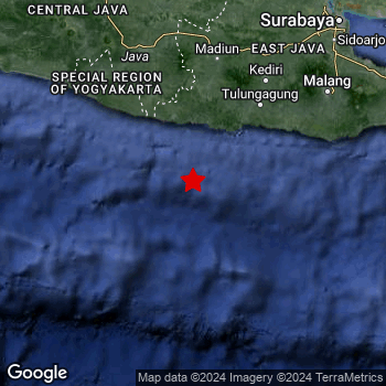 Map of area around epicenter. Click to open in Google Maps. |
| Magnitude: | MAG 5.1 Detected by 54 stations. Maximum Error Range ±0.078 . |
| Depth: | 54 km (34 mi) A quite shallow depth. |
| Tsunami Risk: | Low tsunami risk Earthquakes under MAG-6.5 do not usually cause tsunami's. Always stay cautious - More info here. |
Nearby towns and cities
This earthquake may have been felt in Indonesia . Located 108 kilometer (67 mi) south-southwest of the epicenter of this earthquake, Trenggalek (East Java, Indonesia) is the nearest significant population center.
Multiple major population centers exist within 300km of the earthquake that struck today. Surabaya is located 249 km to the north-east. Semarang is located 238 km to the north-northwest. Malang is located 183 km to the north-east.
The table below provides an overview of all places in proximity of today's earthquake.
Overview of nearby places
| Distance | Place |
|---|---|
| 108 km (67 mi) NNE from epicenter |
Trenggalek East Java, Indonesia. |
| 115 km (71 mi) NE from epicenter |
Boyolangu East Java, Indonesia. |
| 120 km (75 mi) NE from epicenter |
Tulungagung East Java, Indonesia. |
| 121 km (75 mi) N from epicenter |
Jatiroto Central Java, Indonesia. |
| 121 km (75 mi) NE from epicenter |
Kedungwaru East Java, Indonesia. |
| 123 km (76 mi) N from epicenter |
Ponorogo East Java, Indonesia. |
| 124 km (77 mi) NE from epicenter |
Ngunut East Java, Indonesia. |
| 136 km (85 mi) NE from epicenter |
Blitar East Java, Indonesia. |
| 139 km (86 mi) NNW from epicenter |
Selogiri Central Java, Indonesia. |
| 150 km (93 mi) NNE from epicenter |
Kediri East Java, Indonesia. |
| 150 km (93 mi) N from epicenter |
Madiun East Java, Indonesia. |
| 155 km (96 mi) NNE from epicenter |
Gampengrejo East Java, Indonesia. |
| 156 km (97 mi) NNW from epicenter |
Wedi Central Java, Indonesia. |
| 157 km (98 mi) NW from epicenter |
Bambanglipuro Yogyakarta, Indonesia. |
| 158 km (98 mi) NNW from epicenter |
Klaten Central Java, Indonesia. |
| 158 km (98 mi) NW from epicenter |
Sewon Yogyakarta, Indonesia. |
| 159 km (99 mi) NNW from epicenter |
Baki Central Java, Indonesia. |
| 159 km (99 mi) NW from epicenter |
Bantul Yogyakarta, Indonesia. |
| 159 km (99 mi) NNW from epicenter |
Grogol Central Java, Indonesia. |
| 159 km (99 mi) NE from epicenter |
Sumberpucung East Java, Indonesia. |
| 160 km (99 mi) NW from epicenter |
Pandak Yogyakarta, Indonesia. |
| 160 km (99 mi) NW from epicenter |
Candi Prambanan Central Java, Indonesia. |
| 163 km (101 mi) NW from epicenter |
Depok Yogyakarta, Indonesia. |
| 163 km (101 mi) NNW from epicenter |
Karanganom Central Java, Indonesia. |
| 164 km (102 mi) NW from epicenter |
Yogyakarta Yogyakarta, Indonesia. |
| 164 km (102 mi) NNW from epicenter |
Surakarta Central Java, Indonesia. |
| 164 km (102 mi) NW from epicenter |
Kasihan Yogyakarta, Indonesia. |
| 165 km (103 mi) NNW from epicenter |
Gatak Central Java, Indonesia. |
| 165 km (103 mi) NNE from epicenter |
Nganjuk East Java, Indonesia. |
| 166 km (103 mi) NE from epicenter |
Pare East Java, Indonesia. |
| 167 km (104 mi) NW from epicenter |
Gamping Lor Yogyakarta, Indonesia. |
| 168 km (104 mi) NE from epicenter |
Kepanjen East Java, Indonesia. |
| 168 km (104 mi) NNW from epicenter |
Kartasura Central Java, Indonesia. |
| 170 km (106 mi) NW from epicenter |
Melati Yogyakarta, Indonesia. |
| 172 km (107 mi) NW from epicenter |
Godean Yogyakarta, Indonesia. |
| 172 km (107 mi) NW from epicenter |
Sleman Yogyakarta, Indonesia. |
| 173 km (107 mi) N from epicenter |
Sragen Central Java, Indonesia. |
| 176 km (109 mi) NNW from epicenter |
Boyolali Central Java, Indonesia. |
| 177 km (110 mi) NNE from epicenter |
Kertosono East Java, Indonesia. |
| 182 km (113 mi) NE from epicenter |
Batu East Java, Indonesia. |
| 183 km (114 mi) NE from epicenter |
Malang East Java, Indonesia. |
| 188 km (117 mi) NNE from epicenter |
Jombang East Java, Indonesia. |
| 192 km (119 mi) NE from epicenter |
Singosari East Java, Indonesia. |
| 198 km (123 mi) NW from epicenter |
Mertoyudan Central Java, Indonesia. |
| 199 km (124 mi) NE from epicenter |
Lawang East Java, Indonesia. |
| 201 km (125 mi) NNW from epicenter |
Salatiga Central Java, Indonesia. |
| 212 km (132 mi) NNW from epicenter |
Purwodadi Central Java, Indonesia. |
| 238 km (148 mi) NNW from epicenter |
Semarang Central Java, Indonesia. |
| 249 km (155 mi) NE from epicenter |
Surabaya East Java, Indonesia. |
| 279 km (173 mi) ENE from epicenter |
Jember East Java, Indonesia. |
| 291 km (181 mi) NW from epicenter |
Pekalongan Central Java, Indonesia. |
Aftershocks detected
In the days before this main shock, 1 smaller foreshock was detected. Roughly 3 days before this earthquake, a foreshock measuring MAG-3.7 was detected nearby this earthquake.
Overview of foreshocks and aftershocks
| Classification | Magnitude | When | Where |
|---|---|---|---|
| Foreshock | M 3.7 |
3 days earlier Apr 20, 2024 03:40 (Jakarta Time) | 95 km (59 mi) W from Main Shock. |
| Main Shock | M 5.3 |
Apr 22, 2024 18:11 (Jakarta Time) | - |
More earthquakes coming?
The risk of aftershocks decreases rapidly over time. Usually, aftershocks are at least one order of magnitude lower than a main shock.
It's always adviced to be cautious of the risk of a larger shock following any significant earthquake, however this risk is fairly small. There is a roughly 94 percent change that no larger main shock will follow in the days following this earthquake.
Read: How to Stay Safe during an Earthquake (cdc.gov).Earthquakes like this happen often in the region
Earthquakes of this strength are very common in the region. This is the strongest earthquake to hit since December 2nd, 2023, when a 5.2 magnitude earthquake hit 163 km (101 mi) further south-east. An even stronger magnitude 6 earthquake struck on April 10th, 2021.
In total, 29 earthquakes with a magnitude of 5.1 or higher have been registered within 300km (186 mi) of this epicenter in the past 10 years. This comes down to an average of once every 4 months.
Low tsunami risk
Based on early data it appears this earthquake was not strong enough (lower than MAG-6.5) to be likely to cause destructive tsunami's. However this earthquake appeared to have hit at a shallow depth under sea, so stay cautious and monitor advice from local authorities.
Tsunami Risk Factors
| Factor | Under Sea? | MAG-6.5 or stronger? | Shallow depth? |
|---|---|---|---|
| Explanation | Almost all tsunami's are caused by earthquakes with their epicenter under sea or very near the sea. However stay cautious in coastal areas as earthquakes on land may cause landslides into sea, potentially still causing a local tsunami. | Under MAG 6.5: Very unlikely to cause a tsunami. MAG 6.5 to 7.5: Destructive tsunami's do occur, but are uncommon. Likely to observe small sea level changes. MAG 7.6+: Earthquakes with these magnitudes might produce destructive tsunami's. |
Most destructive tsunami's are caused by shallow earthquakes with a depth between 0 and 100km under the surface of the earth. Deeper tsunami's are unlikely to displace to ocean floor. |
| This Earthquake | This earthquake appears to have struck under the sea. | Not this earthquake. This earthquake had a magnitude of 5.1. Earthquakes of this strength are unlikely to trigger a tsunami. |
This earthquake occurred at a depth of of 54 km (34 mi). Earthquakes this shallow could trigger a tsunami. |
Sources
Last updated 04/05/24 00:18 (). This article is automatically generated based on available data. We keep checking multiple sources for additional information. This article gets updated as new details on this earthquake become available.
- US Geographic Society (USGS): Earthquake us7000mdtk
- European-Mediterranean Seismological Centre (EMSC): Earthquake 20240422_0000143
- Geonames.org: World Cities Database
- Google Maps: Static API
- Earthquakelist.org: Historic Earthquakes Database
Share this article:
