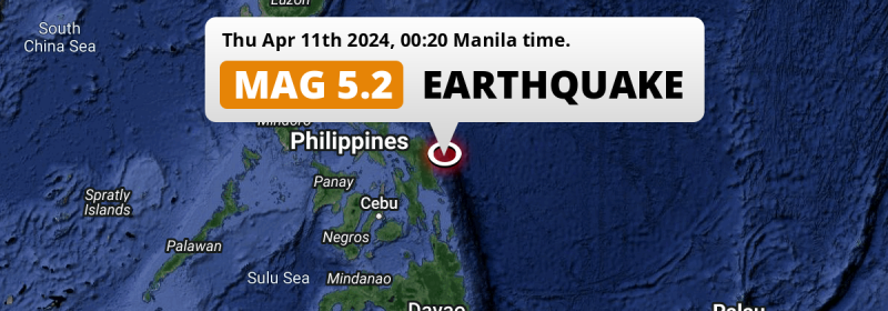
In the Philippine Sea 53 kilometer from Borongan, The Philippines, a shallow and significant M5.2 earthquake occurred just after midnight of Thursday April 11th, 2024.
Felt the earthquake? Share this article: 


Earthquake Summary
This earthquake hit under water in the Philippine Sea, 41 kilometers (26 mi) off the coast of The Philippines, 53 kilometer north-east of Borongan in Eastern Visayas. The center of this earthquake had a very shallow depth of 10 km. Shallow earthquakes usually have a larger impact than earthquakes deep in the earth.
| Date and Time: | Apr 11, 2024 12:20AM (Manila Time) - Apr 10, 2024 16:20 Universal Time. |
|---|---|
| Location: | 53 km NE of Borongan, Eastern Visayas, The Philippines. Coordinates 11°52'14"N 125°50'28"E. |
| Map: | 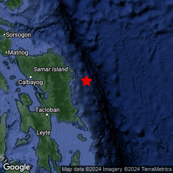 Map of area around epicenter. Click to open in Google Maps. |
| Magnitude: | MAG 5.2 Detected by 22 stations. Maximum Error Range ±0.066 . |
| Depth: | 10 km (6 mi) A very shallow depth. |
| Tsunami Risk: | Low tsunami risk Earthquakes under MAG-6.5 do not usually cause tsunami's. Always stay cautious - More info here. |
Nearby towns and cities
This earthquake may have been felt in The Philippines . Located 53 kilometer (33 mi) north-east of the epicenter of this earthquake, Borongan (Eastern Visayas, The Philippines) is the nearest significant population center.
Major cities near this earthquake: Cebu City is located 274 km to the southwest. Tacloban is located 115 km to the southwest. Panalanoy is located 114 km to the southwest.
The table below provides an overview of all places in proximity of today's earthquake.
Overview of nearby places
| Distance | Place |
|---|---|
| 53 km (33 mi) SW from epicenter |
Borongan Eastern Visayas, The Philippines. |
| 104 km (65 mi) W from epicenter |
Catbalogan Eastern Visayas, The Philippines. |
| 114 km (71 mi) SW from epicenter |
Panalanoy Eastern Visayas, The Philippines. |
| 115 km (71 mi) SW from epicenter |
Tacloban Eastern Visayas, The Philippines. |
| 119 km (74 mi) NW from epicenter |
Laoang Eastern Visayas, The Philippines. |
| 122 km (76 mi) SW from epicenter |
Palo Eastern Visayas, The Philippines. |
| 123 km (76 mi) SW from epicenter |
Tanauan Eastern Visayas, The Philippines. |
| 137 km (85 mi) W from epicenter |
Calbayog City Eastern Visayas, The Philippines. |
| 142 km (88 mi) WSW from epicenter |
Carigara Eastern Visayas, The Philippines. |
| 148 km (92 mi) WNW from epicenter |
Catarman Eastern Visayas, The Philippines. |
| 154 km (96 mi) SW from epicenter |
Abuyog Eastern Visayas, The Philippines. |
| 165 km (103 mi) SW from epicenter |
Ormoc Eastern Visayas, The Philippines. |
| 174 km (108 mi) SW from epicenter |
Baybay Eastern Visayas, The Philippines. |
| 217 km (135 mi) WNW from epicenter |
Irosin Bicol, The Philippines. |
| 220 km (137 mi) WSW from epicenter |
Bogo Central Visayas, The Philippines. |
| 222 km (138 mi) SSW from epicenter |
Maasin Eastern Visayas, The Philippines. |
| 231 km (144 mi) WNW from epicenter |
Bulan Bicol, The Philippines. |
| 235 km (146 mi) S from epicenter |
Surigao Caraga, The Philippines. |
| 235 km (146 mi) WNW from epicenter |
Sorsogon Bicol, The Philippines. |
| 244 km (152 mi) SW from epicenter |
Cogan Central Visayas, The Philippines. |
| 244 km (152 mi) WSW from epicenter |
Bantayan Central Visayas, The Philippines. |
| 247 km (153 mi) WNW from epicenter |
Masbate Bicol, The Philippines. |
| 248 km (154 mi) SW from epicenter |
Danao Central Visayas, The Philippines. |
| 254 km (158 mi) SW from epicenter |
Compostela Central Visayas, The Philippines. |
| 258 km (160 mi) NW from epicenter |
Virac Bicol, The Philippines. |
| 259 km (161 mi) SW from epicenter |
Liloan Central Visayas, The Philippines. |
| 264 km (164 mi) SW from epicenter |
Consolacion Central Visayas, The Philippines. |
| 268 km (167 mi) WNW from epicenter |
Legaspi Bicol, The Philippines. |
| 270 km (168 mi) SW from epicenter |
Lapu-Lapu City Central Visayas, The Philippines. |
| 271 km (168 mi) SW from epicenter |
Apas Central Visayas, The Philippines. |
| 271 km (168 mi) SW from epicenter |
Mandaue City Central Visayas, The Philippines. |
| 272 km (169 mi) WNW from epicenter |
Tagas Bicol, The Philippines. |
| 274 km (170 mi) SW from epicenter |
Cebu City Central Visayas, The Philippines. |
| 275 km (171 mi) SW from epicenter |
Cordova Central Visayas, The Philippines. |
| 277 km (172 mi) SW from epicenter |
Balamban Central Visayas, The Philippines. |
| 279 km (173 mi) NW from epicenter |
Malilipot Bicol, The Philippines. |
| 280 km (174 mi) WSW from epicenter |
Escalante Western Visayas, The Philippines. |
| 282 km (175 mi) NW from epicenter |
Tabaco Bicol, The Philippines. |
| 283 km (176 mi) WSW from epicenter |
Sagay Western Visayas, The Philippines. |
| 283 km (176 mi) SW from epicenter |
Talisay Central Visayas, The Philippines. |
| 287 km (178 mi) SW from epicenter |
Minglanilla Central Visayas, The Philippines. |
| 292 km (181 mi) WSW from epicenter |
Paraiso Western Visayas, The Philippines. |
| 292 km (181 mi) SW from epicenter |
Toledo Central Visayas, The Philippines. |
| 293 km (182 mi) SW from epicenter |
Naga Central Visayas, The Philippines. |
| 293 km (182 mi) NW from epicenter |
Tiwi Bicol, The Philippines. |
| 294 km (183 mi) SSW from epicenter |
Jagna Central Visayas, The Philippines. |
| 297 km (185 mi) WSW from epicenter |
Cadiz Western Visayas, The Philippines. |
| 298 km (185 mi) WNW from epicenter |
San Jose Bicol, The Philippines. |
Shaking reported by 4 people
People that feel an earthquake may report their experience to the US Geographic Survey. Currently, 4 people have reported shaking in 3 places, all within Philippines.We keep updating this article as more ground reports become available. You may report that you felt this earthquake here.
Places with most reports:
- San Antonio (Basey, Samar), Eastern Visayas, Philippines: 2 people.
- Calero, Central Visayas, Philippines: 1 person.
- Panabo, Southern Mindanao, Philippines: 1 person.
6 Aftershocks detected
Since this main shock, 6 smaller aftershocks were detected. A 4.7 magnitude earthquake hit 3 days later 8 km (5 mi) west of this earthquake.
Before this earthquake struck, 2 smaller foreshocks occurred. Nearby this earthquake a foreshock struck 9 hrs earlier. It measured a magnitude of 3.8
Overview of foreshocks and aftershocks
| Classification | Magnitude | When | Where |
|---|---|---|---|
| Foreshock | M 3.0 |
11 hrs earlier Apr 10, 2024 12:56PM (Manila Time) | 39 km (24 mi) ENE from Main Shock. |
| Foreshock | M 3.8 |
9 hrs earlier Apr 10, 2024 02:54PM (Manila Time) | 36 km (22 mi) WSW from Main Shock. |
| Main Shock This Earthquake |
M 5.2 |
Apr 11, 2024 12:20AM (Manila Time) | - |
| Aftershock | M 3.5 |
10 hrs later Apr 11, 2024 10:05AM (Manila Time) | 17 km (10 mi) ENE from Main Shock. |
| Aftershock | M 3.1 |
1 day later Apr 12, 2024 03:44AM (Manila Time) | 45 km (28 mi) ENE from Main Shock. |
| Aftershock | M 3.7 |
2 days later Apr 13, 2024 04:57AM (Manila Time) | 17 km (11 mi) NE from Main Shock. |
| Aftershock | M 3.6 |
2 days later Apr 13, 2024 09:46AM (Manila Time) | 48 km (30 mi) E from Main Shock. |
| Aftershock | M 3.3 |
2 days later Apr 13, 2024 09:52AM (Manila Time) | 49 km (30 mi) ENE from Main Shock. |
| Aftershock | M 4.7 |
3 days later Apr 13, 2024 05:10PM (Manila Time) | 8 km (5 mi) W from Main Shock. |
More earthquakes coming?
Aftershocks are usually at least 1 order of magnitude less strong than main shocks. The more time passes, the smaller the chance and likely strength of any potential aftershocks.
In only six percent of cases, significant earthquakes are followed by a larger main shock, making the current earthquake a foreshock. While the chance of this happening is not so large, it is adviced to maintain cautiousness in the hours and days following a major earthquake.
Read: How to Stay Safe during an Earthquake (cdc.gov).Earthquakes like this happen often in the region
Earthquakes of this strength are very common in the region. This is the strongest earthquake to hit since February 12th, 2024, when a 5.3 magnitude earthquake hit 257 km (160 mi) further south-southeast. An even stronger magnitude 6.6 earthquake struck on August 18th, 2020.
In total, 42 earthquakes with a magnitude of 5.2 or higher have been registered within 300km (186 mi) of this epicenter in the past 10 years. This comes down to an average of once every 3 months.
Low tsunami risk
Based on early data it appears this earthquake was not strong enough (lower than MAG-6.5) to be likely to cause destructive tsunami's. However this earthquake appeared to have hit at a shallow depth under sea, so stay cautious and monitor advice from local authorities.
Tsunami Risk Factors
| Factor | Under Sea? | MAG-6.5 or stronger? | Shallow depth? |
|---|---|---|---|
| Explanation | Almost all tsunami's are caused by earthquakes with their epicenter under sea or very near the sea. However stay cautious in coastal areas as earthquakes on land may cause landslides into sea, potentially still causing a local tsunami. | Under MAG 6.5: Very unlikely to cause a tsunami. MAG 6.5 to 7.5: Destructive tsunami's do occur, but are uncommon. Likely to observe small sea level changes. MAG 7.6+: Earthquakes with these magnitudes might produce destructive tsunami's. |
Most destructive tsunami's are caused by shallow earthquakes with a depth between 0 and 100km under the surface of the earth. Deeper tsunami's are unlikely to displace to ocean floor. |
| This Earthquake | This earthquake appears to have struck under the sea. | Not this earthquake. This earthquake had a magnitude of 5.2. Earthquakes of this strength are unlikely to trigger a tsunami. |
This earthquake occurred at a depth of of 10 km (6 mi). Earthquakes this shallow could trigger a tsunami. |
Sources
Last updated 04/05/24 00:38 (). This article is automatically generated based on available data. We keep checking multiple sources for additional information. This article gets updated as new details on this earthquake become available.
- US Geographic Society (USGS): Earthquake us7000mb7s
- European-Mediterranean Seismological Centre (EMSC): Earthquake 20240410_0000183
- Geonames.org: World Cities Database
- Google Maps: Static API
- Earthquakelist.org: Historic Earthquakes Database
Share this article:
