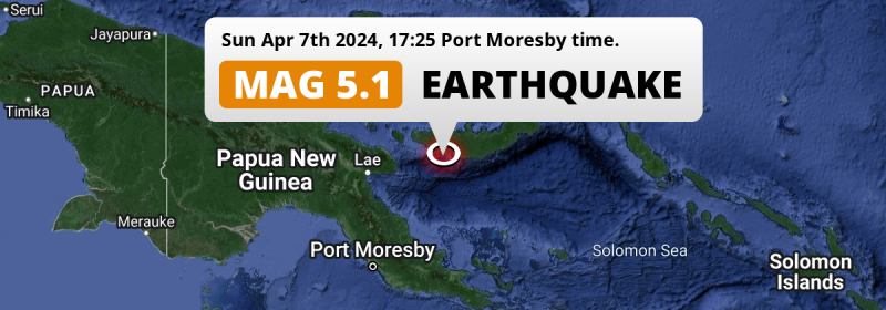
In the late afternoon of Sunday April 7th, 2024, a significant M5.1 earthquake hit in the Solomon Sea 135 kilometer from Kimbe, Papua New Guinea.
Felt the earthquake? Share this article: 


Earthquake Summary
This earthquake hit under water in the Solomon Sea, 30 kilometers (19 mi) off the coast of Papua New Guinea, 135 kilometer southwest of Kimbe in West New Britain. The center of this earthquake had a quite shallow depth of 54 km. Shallow earthquakes usually have a larger impact than earthquakes deep in the earth.
| Date and Time: | Apr 7, 2024 17:25 (Port Moresby Time) - Apr 7, 2024 07:25 Universal Time. |
|---|---|
| Location: | 135 km SW of Kimbe, West New Britain, Papua New Guinea. Coordinates 6°23'36"S 149°15'36"E. |
| Map: | 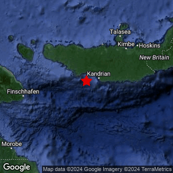 Map of area around epicenter. Click to open in Google Maps. |
| Magnitude: | MAG 5.1 Detected by 90 stations. Maximum Error Range ±0.06 . |
| Depth: | 54 km (34 mi) A quite shallow depth. |
| Tsunami Risk: | Low tsunami risk Earthquakes under MAG-6.5 do not usually cause tsunami's. Always stay cautious - More info here. |
Nearby towns and cities
This earthquake may have been felt in Papua New Guinea . The closest significant population center near the earthquake is Kimbe in West New Britain, Papua New Guinea. Kimbe is located 135 kilometer (84 mi) southwest of the epicenter.
Overview of nearby places
| Distance | Place |
|---|---|
| 135 km (84 mi) NE from epicenter |
Kimbe West New Britain, Papua New Guinea. |
| 253 km (157 mi) W from epicenter |
Lae Morobe, Papua New Guinea. |
| 287 km (178 mi) SSW from epicenter |
Popondetta Northern Province, Papua New Guinea. |
Shaking reported by 2 people
People that feel an earthquake may report their experience to the US Geographic Survey. Currently, 2 people have reported shaking in one place in Papua New Guinea.We keep updating this article as more ground reports become available. You may report that you felt this earthquake here.
Places with most reports:
- Kimbe, West New Britain, Papua New Guinea: 2 people.
Risk of aftershocks?
We monitor for foreshocks or aftershocks that have a magnitude of 2.5+ and occur within 100km (62 mi) of the epicenter of this earthquake. So far no such earthquakes have been detected.
Aftershocks are usually at least 1 order of magnitude less strong than main shocks. The more time passes, the smaller the chance and likely strength of any potential aftershocks.
The chance that a significant earthquake like this one is followed by an even larger earthquake is not so large. On average, scientists estimate a 94% chance that a major earthquake will not be followed by an even larger one. It is still adviced to be aware of this risk
Read: How to Stay Safe during an Earthquake (cdc.gov).Earthquakes like this happen often in the region
Earthquakes of this strength are very common in the region. This is the strongest earthquake to hit since March 29th, 2024, when a 5.6 magnitude earthquake hit 205 km (128 mi) further north. An even stronger magnitude 7 earthquake struck on July 17th, 2020.
In total, 162 earthquakes with a magnitude of 5.1 or higher have been registered within 300km (186 mi) of this epicenter in the past 10 years. This comes down to an average of once every 23 days.
Low tsunami risk
Based on early data it appears this earthquake was not strong enough (lower than MAG-6.5) to be likely to cause destructive tsunami's. However this earthquake appeared to have hit at a shallow depth under sea, so stay cautious and monitor advice from local authorities.
Tsunami Risk Factors
| Factor | Under Sea? | MAG-6.5 or stronger? | Shallow depth? |
|---|---|---|---|
| Explanation | Almost all tsunami's are caused by earthquakes with their epicenter under sea or very near the sea. However stay cautious in coastal areas as earthquakes on land may cause landslides into sea, potentially still causing a local tsunami. | Under MAG 6.5: Very unlikely to cause a tsunami. MAG 6.5 to 7.5: Destructive tsunami's do occur, but are uncommon. Likely to observe small sea level changes. MAG 7.6+: Earthquakes with these magnitudes might produce destructive tsunami's. |
Most destructive tsunami's are caused by shallow earthquakes with a depth between 0 and 100km under the surface of the earth. Deeper tsunami's are unlikely to displace to ocean floor. |
| This Earthquake | This earthquake appears to have struck under the sea. | Not this earthquake. This earthquake had a magnitude of 5.1. Earthquakes of this strength are unlikely to trigger a tsunami. |
This earthquake occurred at a depth of of 54 km (34 mi). Earthquakes this shallow could trigger a tsunami. |
Sources
Last updated 03/05/24 11:08 (). This article contains currently available information about the earthquake and is automatically composed. We continue to update this article up to a few days after the earthquake occurred.
- US Geographic Society (USGS): Earthquake us7000make
- European-Mediterranean Seismological Centre (EMSC): Earthquake 20240407_0000083
- Geonames.org: World Cities Database
- Google Maps: Static API
- Earthquakelist.org: Historic Earthquakes Database
Share this article:
