
Under land 43 miles from Oklahoma City in The United States, an unusually powerful M5.1 earthquake occurred in the evening of Friday February 2nd, 2024. Around 4.4 million people have been exposed to shaking.
Felt the earthquake? Share this article: 


Earthquake Summary
The earthquake struck on land in The United States, 43 miles (69 km) east of Oklahoma City in Oklahoma. The center of this earthquake had a very shallow depth of 2 km. Shallow earthquakes usually have a larger impact than earthquakes deep in the earth.
| Date and Time: | Feb 2, 2024 11:24PM (Chicago Time) - Feb 3, 2024 05:24 Universal Time. |
|---|---|
| Location: | 43 mi east of Oklahoma City, Oklahoma, The United States. Coordinates 35°32'4"N 96°45'50"W. |
| Map: | 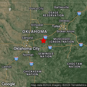 Map of area around epicenter. Click to open in Google Maps. |
| Magnitude: | MAG 5.1 Detected by 78 stations. Maximum Error Range ±0.035 . |
| Depth: | 2 mi (3 km) A very shallow depth. |
| Max. Intensity: | VIII
Severe On the Modified Mercalli Scale. |
| Tsunami Risk: | Tsunami very unlikely While this was a shallow earthquake, it appears to have occurred under land with a magnitude not strong enough to cause tsunami's. Always stay cautious - More info here. |
Minimal impact predicted
The US Geographic Survey (USGS) describes the impact of this earthquake as follows:
Several homes and buildings damaged at Prague.
Based on scientific estimates by the USGS, the risk of high fatalities for this earthquake is classified at level GREEN (low). They expect an 69% likelyhood of between 0 and 1 fatalities, and a 98% chance that the number of fatalities falls no higher than 10.
The USGS classifies the economic impact of this earthquake at level GREEN (low). They expect an 82% likelyhood of between 0 and 1 million US Dollars in economic damage and impact, and a 99% chance that the economic impact of this earthquake falls no higher than 10 million USD.
Roughly 4.4 million people exposed to shaking
This earthquake may have been felt by around 4.4 million people. That is the expected population size of the area exposed to a level of shaking of II or higher on the Modified Mercalli scale according to the USGS.
An estimated 250 people were exposed to level VII. At this level, very strong shaking and likely moderate damage can be expected. The majority of people (roughly 2.5 million) live in an area exposed to level IV, where light shaking and likely no damage is expected.
| People | MMI Level | Shaking | Damage |
|---|---|---|---|
| 0 | I |
Not noticable | None |
| 0 | II |
Very weak | None |
| 1,878,000 | III |
Weak | Probably none |
| 2,468,000 | IV |
Light | Likely none |
| 18,770 | V |
Moderate | Very light |
| 1,650 | VI |
Strong | Light |
| 250 | VII |
Very Strong | Moderate |
| 0 | VIII |
Severe | Moderate to heavy |
| 0 | IX |
Violent | Heavy |
| 0 | X |
Extreme | Very heavy |
Nearby towns and cities
This earthquake may have been felt in The United States . The closest significant population center near the earthquake is Shawnee in Oklahoma, The United States. Shawnee is located 17 miles (27 km) north-northeast of the epicenter. Shawnee experienced an earthquake intensity (MMI Scale) of roughly IV. That level implies light shaking and likely no damage.
Multiple large cities are in proximity of today's earthquake. Oklahoma City is located 43 mi to the west and experienced an intensity of IV (light shaking, likely no damage). Tulsa is located 61 mi to the north-east and experienced an intensity of IV (light shaking, likely no damage). Norman is located 43 mi to the west-southwest and experienced an intensity of III (weak shaking, probably no damage).
An overview of nearby towns and cities is available in the overview below. If places don't have intensity data available, it likely means the experienced impact in those places was fairly small.
Overview of nearby places
| Distance | Place | Intensity (MMI) |
|---|---|---|
| 17 mi (27 km) SSW from epicenter |
Shawnee Oklahoma, The United States. |
IV
Light |
| 36 mi (58 km) W from epicenter |
Midwest City Oklahoma, The United States. |
IV
Light |
| 39 mi (62 km) W from epicenter |
Del City Oklahoma, The United States. |
IV
Light |
| 41 mi (66 km) W from epicenter |
Edmond Oklahoma, The United States. |
IV
Light |
| 43 mi (69 km) W from epicenter |
Oklahoma City Oklahoma, The United States. |
IV
Light |
| 43 mi (69 km) WSW from epicenter |
Moore Oklahoma, The United States. |
III
Weak |
| 43 mi (70 km) WSW from epicenter |
Norman Oklahoma, The United States. |
III
Weak |
| 43 mi (70 km) NNW from epicenter |
Stillwater Oklahoma, The United States. |
IV
Light |
| 48 mi (78 km) NE from epicenter |
Sapulpa Oklahoma, The United States. |
IV
Light |
| 49 mi (79 km) W from epicenter |
Bethany Oklahoma, The United States. |
IV
Light |
| 53 mi (85 km) S from epicenter |
Ada Oklahoma, The United States. |
IV
Light |
| 55 mi (89 km) W from epicenter |
Mustang Oklahoma, The United States. |
III
Weak |
| 56 mi (90 km) NE from epicenter |
Jenks Oklahoma, The United States. |
IV
Light |
| 56 mi (90 km) NE from epicenter |
Sand Springs Oklahoma, The United States. |
IV
Light |
| 56 mi (90 km) W from epicenter |
Yukon Oklahoma, The United States. |
III
Weak |
| 57 mi (91 km) ENE from epicenter |
Bixby Oklahoma, The United States. |
IV
Light |
| 61 mi (98 km) NE from epicenter |
Tulsa Oklahoma, The United States. |
IV
Light |
| 65 mi (105 km) NE from epicenter |
Broken Arrow Oklahoma, The United States. |
IV
Light |
| 67 mi (108 km) W from epicenter |
El Reno Oklahoma, The United States. |
IV
Light |
| 70 mi (112 km) SE from epicenter |
McAlester Oklahoma, The United States. |
IV
Light |
| 72 mi (116 km) NE from epicenter |
Owasso Oklahoma, The United States. |
IV
Light |
| 74 mi (119 km) WSW from epicenter |
Chickasha Oklahoma, The United States. |
IV
Light |
| 80 mi (128 km) E from epicenter |
Muskogee Oklahoma, The United States. |
IV
Light |
| 83 mi (134 km) NNW from epicenter |
Ponca City Oklahoma, The United States. |
IV
Light |
| 84 mi (135 km) NE from epicenter |
Claremore Oklahoma, The United States. |
IV
Light |
| 86 mi (139 km) NW from epicenter |
Enid Oklahoma, The United States. |
IV
Light |
| 94 mi (152 km) NNE from epicenter |
Bartlesville Oklahoma, The United States. |
III
Weak |
| 96 mi (155 km) SSW from epicenter |
Ardmore Oklahoma, The United States. |
III
Weak |
| 98 mi (158 km) SW from epicenter |
Duncan Oklahoma, The United States. |
IV
Light |
| 104 mi (167 km) ENE from epicenter |
Tahlequah Oklahoma, The United States. |
IV
Light |
| 109 mi (175 km) SSE from epicenter |
Durant Oklahoma, The United States. |
III
Weak |
| 112 mi (180 km) SW from epicenter |
Lawton Oklahoma, The United States. |
III
Weak |
| 124 mi (199 km) S from epicenter |
Denison Texas, The United States. |
III
Weak |
| 132 mi (212 km) S from epicenter |
Sherman Texas, The United States. |
|
| 134 mi (215 km) E from epicenter |
Fort Smith Arkansas, The United States. |
|
| 149 mi (240 km) SW from epicenter |
Wichita Falls Texas, The United States. |
III
Weak |
| 150 mi (242 km) ENE from epicenter |
Fayetteville Arkansas, The United States. |
|
| 152 mi (245 km) NNW from epicenter |
Wichita Kansas, The United States. |
|
| 154 mi (248 km) ENE from epicenter |
Springdale Arkansas, The United States. |
|
| 158 mi (254 km) ENE from epicenter |
Rogers Arkansas, The United States. |
|
| 162 mi (260 km) S from epicenter |
McKinney Texas, The United States. |
|
| 162 mi (260 km) S from epicenter |
Denton Texas, The United States. |
|
| 165 mi (265 km) NE from epicenter |
Joplin Missouri, The United States. |
III
Weak |
| 165 mi (265 km) S from epicenter |
Frisco Texas, The United States. |
|
| 168 mi (270 km) S from epicenter |
Allen Texas, The United States. |
|
| 172 mi (277 km) S from epicenter |
Lewisville Texas, The United States. |
|
| 174 mi (280 km) S from epicenter |
Plano Texas, The United States. |
|
| 175 mi (282 km) S from epicenter |
Flower Mound Texas, The United States. |
|
| 178 mi (287 km) S from epicenter |
Carrollton Texas, The United States. |
|
| 179 mi (288 km) S from epicenter |
Richardson Texas, The United States. |
|
| 181 mi (292 km) S from epicenter |
Garland Texas, The United States. |
Earthquake Intensity Map
The graph below overlays a map of the region around the epicenter with earthquake intensity data provided by the US Geographic Survey. The highest intensity level detected for this earthquake is VII.

Shaking reported by 5 people
People that feel an earthquake may report their experience to the US Geographic Survey. Currently, 5 people have reported shaking in 3 places, all within Canada.We keep updating this article as more ground reports become available. You may report that you felt this earthquake here.
Places with most reports:
- Stonewall, Manitoba, Canada: 3 people.
- Athabasca, Alberta, Canada: 1 person.
- Dunnville, Ontario, Canada: 1 person.
9 Aftershocks detected
This main shock was followed by 9 smaller aftershocks. A 3.5 magnitude earthquake hit 1 hr later 0.9 mi (1.4 km) south-southwest of this earthquake.
Overview of foreshocks and aftershocks
| Classification | Magnitude | When | Where |
|---|---|---|---|
| Main Shock This Earthquake |
M 5.1 |
Feb 2, 2024 11:24PM (Chicago Time) | - |
| Aftershock | M 2.7 |
12 mins later Feb 2, 2024 11:36PM (Chicago Time) | 0.2 mi (0.4 km) ESE from Main Shock. |
| Aftershock | M 2.5 |
12 mins later Feb 2, 2024 11:36PM (Chicago Time) | 0.9 mi (1.5 km) SW from Main Shock. |
| Aftershock | M 3.5 |
1 hr later Feb 3, 2024 12:33AM (Chicago Time) | 0.9 mi (1.4 km) SSW from Main Shock. |
| Aftershock | M 3.0 |
3 hrs later Feb 3, 2024 02:19AM (Chicago Time) | 0.6 mi (1 km) NE from Main Shock. |
| Aftershock | M 3.2 |
4 hrs later Feb 3, 2024 03:16AM (Chicago Time) | 1.7 mi (2.8 km) NNE from Main Shock. |
| Aftershock | M 2.9 |
5 hrs later Feb 3, 2024 04:48AM (Chicago Time) | 1.8 mi (2.9 km) NE from Main Shock. |
| Aftershock | M 2.9 |
6 hrs later Feb 3, 2024 05:21AM (Chicago Time) | 1.7 mi (2.8 km) NNE from Main Shock. |
| Aftershock | M 2.5 |
9 hrs later Feb 3, 2024 08:12AM (Chicago Time) | 1.7 mi (2.8 km) NE from Main Shock. |
| Aftershock | M 2.5 |
2 days later Feb 5, 2024 08:56AM (Chicago Time) | 0.7 mi (1.1 km) ENE from Main Shock. |
More earthquakes coming?
Aftershocks are usually at least 1 order of magnitude less strong than main shocks. The more time passes, the smaller the chance and likely strength of any potential aftershocks.
It's always adviced to be cautious of the risk of a larger shock following any significant earthquake, however this risk is fairly small. There is a roughly 94 percent change that no larger main shock will follow in the days following this earthquake.
Read: How to Stay Safe during an Earthquake (cdc.gov).This is the strongest earthquake in 7 years
Earthquakes of this strength are not so common in the region, but it's not the first time. This is the strongest earthquake to hit since September 3rd, 2016, when a 5.8 magnitude earthquake hit 62 mi (100 km) further north. That was also the heaviest earthquake to hit the region in the past 10 years.
In total, 1 earthquake with a magnitude of 5.1 or higher have been registered within 300km (186 mi) of this epicenter in the past 10 years. This comes down to an average of once every 10 years.
Tsunami very unlikely
While MAG-6.5+ earthquakes may cause tsunami's, it appears that the epicenter of this earthquake hit under land. In addition, the reported depth is deeper than 100km, making the risk of a tsunami even less likely. However always stay cautious and monitor advice from local authorities.
Tsunami Risk Factors
| Factor | Under Sea? | MAG-6.5 or stronger? | Shallow depth? |
|---|---|---|---|
| Explanation | Almost all tsunami's are caused by earthquakes with their epicenter under sea or very near the sea. However stay cautious in coastal areas as earthquakes on land may cause landslides into sea, potentially still causing a local tsunami. | Under MAG 6.5: Very unlikely to cause a tsunami. MAG 6.5 to 7.5: Destructive tsunami's do occur, but are uncommon. Likely to observe small sea level changes. MAG 7.6+: Earthquakes with these magnitudes might produce destructive tsunami's. |
Most destructive tsunami's are caused by shallow earthquakes with a depth between 0 and 100km under the surface of the earth. Deeper tsunami's are unlikely to displace to ocean floor. |
| This Earthquake | Not this earthquake. This earthquake appears to have struck on land far from any coast. |
Not this earthquake. This earthquake had a magnitude of 5.1. Earthquakes of this strength are unlikely to trigger a tsunami. |
This earthquake occurred at a depth of of 2 mi (3 km). Earthquakes this shallow could trigger a tsunami. |
Sources
Last updated 02/04/24 06:28 (). This article is automatically generated based on available data. We keep checking multiple sources for additional information. This article gets updated as new details on this earthquake become available.
- US Geographic Society (USGS): Earthquake ok2024cish
- European-Mediterranean Seismological Centre (EMSC): Earthquake 20240203_0000084
- Geonames.org: World Cities Database
- Google Maps: Static API
- Earthquakelist.org: Historic Earthquakes Database
Share this article:
