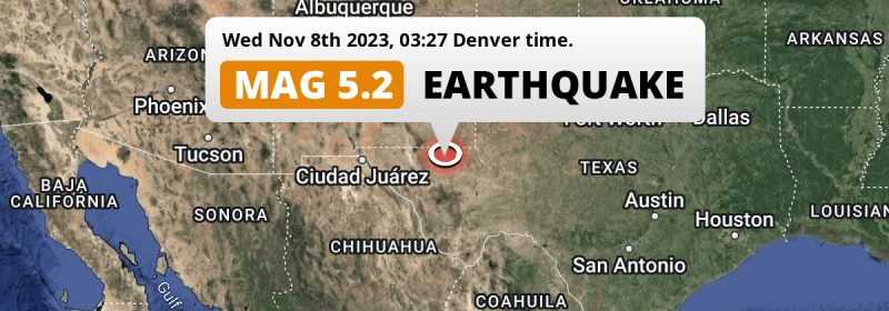
An unusually powerful M5.2 earthquake struck under land 57 miles from Carlsbad in The United States deep in the night of Wednesday November 8th, 2023. Around 0.8 million people have been exposed to shaking. Another country near the epicenter is Mexico.
Felt the earthquake? Share this article: 


Earthquake Summary
The earthquake struck on land in The United States, 57 miles (92 km) south-southeast of Carlsbad in New Mexico. The center of this earthquake had a very shallow depth of 5 km. Shallow earthquakes usually have a larger impact than earthquakes deep in the earth.
| Date and Time: | Nov 8, 2023 03:27AM (Denver Time) - Nov 8, 2023 10:27 Universal Time. |
|---|---|
| Location: | 57 mi SSE of Carlsbad, New Mexico, The United States. Coordinates 31°37'19"N 103°58'55"W. |
| Map: | 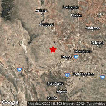 Map of area around epicenter. Click to open in Google Maps. |
| Magnitude: | MAG 5.2 Detected by 44 stations. Maximum Error Range ±0.047 . |
| Depth: | 5 mi (7 km) A very shallow depth. |
| Max. Intensity: | VII
Very Strong On the Modified Mercalli Scale. |
| Tsunami Risk: | Tsunami very unlikely While this was a shallow earthquake, it appears to have occurred under land with a magnitude not strong enough to cause tsunami's. Always stay cautious - More info here. |
Minimal impact predicted
The US Geographic Survey (USGS) describes the impact of this earthquake as follows:
Some people injured and minor damaged occurred in the Mentone area.
Based on scientific estimates by the USGS, the risk of high fatalities for this earthquake is classified at level GREEN (low). They expect an 65% likelyhood of between 0 and 1 fatalities, and a 96% chance that the number of fatalities falls no higher than 10.
The USGS classifies the economic impact of this earthquake at level GREEN (low). They expect an 65% likelyhood of between 0 and 1 million US Dollars in economic damage and impact, and a 96% chance that the economic impact of this earthquake falls no higher than 10 million USD.
Roughly 0.8 million people exposed to shaking
This earthquake may have been felt by around 0.8 million people. That is the expected population size of the area exposed to a level of shaking of II or higher on the Modified Mercalli scale according to the USGS.
Strong shaking and probably light damage may have been experienced by an estimated 20 people. At VI, it is the highest MMI level this earthquake has caused. The majority of people (roughly 450 thousand) live in an area exposed to level III, where weak shaking and probably no damage is expected. All exposure to shaking was within the borders of Mexico .
| People | MMI Level | Shaking | Damage |
|---|---|---|---|
| 0 | I |
Not noticable | None |
| 0 | II |
Very weak | None |
| 451,400 | III |
Weak | Probably none |
| 310,700 | IV |
Light | Likely none |
| 130 | V |
Moderate | Very light |
| 20 | VI |
Strong | Light |
| 0 | VII |
Very Strong | Moderate |
| 0 | VIII |
Severe | Moderate to heavy |
| 0 | IX |
Violent | Heavy |
| 0 | X |
Extreme | Very heavy |
Nearby towns and cities
2 countries can be found within 300km of the epicenter of this earthquake: The United States and Mexico .
Located 57 miles (92 km) south-southeast of the epicenter of this earthquake, Carlsbad (New Mexico, The United States) is the nearest significant population center. The intensity of shaking and damage in Carlsbad is estimated to be around level IV on the Modified Mercalli Intensity scale (light shaking, likely no damage).
Multiple large cities are in proximity of today's earthquake. Ciudad Juárez is located 235 km to the west (intensity unknown, possibly low). El Paso is located 147 mi to the west (intensity unknown, possibly low). Lubbock is located 183 mi to the north-east (intensity unknown, possibly low).
A complete list of nearby places is included below. Estimated intensity data (MMI) sourced from a shake-map published by the US Geographic Survey is shown where available (cities without data probably experienced little impact).
Overview of nearby places
| Distance | Place | Intensity (MMI) |
|---|---|---|
| 57 mi (92 km) NNW from epicenter |
Carlsbad New Mexico, The United States. |
IV
Light |
| 88 mi (142 km) E from epicenter |
West Odessa Texas, The United States. |
IV
Light |
| 89 mi (144 km) NNE from epicenter |
Hobbs New Mexico, The United States. |
IV
Light |
| 96 mi (155 km) E from epicenter |
Odessa Texas, The United States. |
IV
Light |
| 115 mi (185 km) ENE from epicenter |
Midland Texas, The United States. |
III
Weak |
| 127 mi (204 km) NNW from epicenter |
Roswell New Mexico, The United States. |
III
Weak |
| 131 mi (211 km) W from epicenter |
Horizon City Texas, The United States. |
|
| 136 mi (219 km) W from epicenter |
Socorro Mission Number 1 Colonia Texas, The United States. |
|
| 137 mi (220 km) W from epicenter |
Socorro Texas, The United States. |
|
| 233 km (145 mi) S from epicenter |
Manuel Ojinaga Chihuahua, Mexico. |
|
| 145 mi (234 km) NW from epicenter |
Alamogordo New Mexico, The United States. |
III
Weak |
| 235 km (146 mi) W from epicenter |
Ciudad Juárez Chihuahua, Mexico. |
|
| 235 km (146 mi) SSW from epicenter |
Ojinaga Chihuahua, Mexico. |
|
| 147 mi (237 km) W from epicenter |
El Paso Texas, The United States. |
|
| 153 mi (246 km) ENE from epicenter |
Big Spring Texas, The United States. |
|
| 153 mi (247 km) W from epicenter |
Sunland Park New Mexico, The United States. |
|
| 171 mi (275 km) WNW from epicenter |
Las Cruces New Mexico, The United States. |
|
| 183 mi (295 km) NE from epicenter |
Lubbock Texas, The United States. |
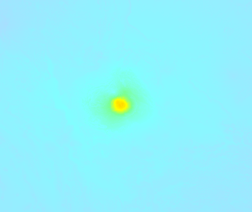
Earthquake Intensity Map
The intensity in shaking and damage by this earthquake is illustrated through the map below. The highest intensity measured for this earthquake is VII.
Shaking reported by 5 people
People that feel an earthquake may report their experience to the US Geographic Survey. Currently, 5 people have reported shaking in 2 places in Mexico.We keep updating this article as more ground reports become available. You may report that you felt this earthquake here.
Places with most reports:
- Juárez, Chihuahua, Mexico: 3 people.
- Praxédis Guerrero, Chihuahua, Mexico: 2 people.
23 Aftershocks detected
Since this main shock, 23 smaller aftershocks were detected. At a distance of 1.4 mi (2.3 km) north-northeast of this earthquake, an aftershock struck 2 days later. It measured a magnitude of 3.4
Before this earthquake struck, 8 smaller foreshocks occurred. Roughly 1 day before this earthquake, a foreshock measuring MAG-3.4 was detected nearby this earthquake.
Overview of foreshocks and aftershocks
| Classification | Magnitude | When | Where |
|---|---|---|---|
| Foreshock | M 2.9 |
3 days earlier Nov 5, 2023 08:48AM (Denver Time) | 26 mi (42 km) W from Main Shock. |
| Foreshock | M 2.8 |
2 days earlier Nov 6, 2023 02:01PM (Denver Time) | 19 mi (31 km) W from Main Shock. |
| Foreshock | M 2.8 |
2 days earlier Nov 6, 2023 02:01PM (Denver Time) | 19 mi (31 km) W from Main Shock. |
| Foreshock | M 2.9 |
1 day earlier Nov 6, 2023 04:44PM (Denver Time) | 19 mi (31 km) W from Main Shock. |
| Foreshock | M 3.4 |
1 day earlier Nov 6, 2023 09:02PM (Denver Time) | 20 mi (32 km) W from Main Shock. |
| Foreshock | M 2.9 |
1 day earlier Nov 6, 2023 09:27PM (Denver Time) | 20 mi (32 km) W from Main Shock. |
| Foreshock | M 2.6 |
1 day earlier Nov 6, 2023 10:44PM (Denver Time) | 28 mi (45 km) W from Main Shock. |
| Foreshock | M 2.6 |
19 hrs earlier Nov 7, 2023 08:38AM (Denver Time) | 22 mi (35 km) W from Main Shock. |
| Main Shock This Earthquake |
M 5.2 |
Nov 8, 2023 03:27AM (Denver Time) | - |
| Aftershock | M 3.2 |
2 mins later Nov 8, 2023 03:30AM (Denver Time) | 0.9 mi (1.5 km) SW from Main Shock. |
| Aftershock | M 2.8 |
3 mins later Nov 8, 2023 03:31AM (Denver Time) | 0.1 mi (0.2 km) E from Main Shock. |
| Aftershock | M 2.6 |
7 mins later Nov 8, 2023 03:35AM (Denver Time) | 0.8 mi (1.3 km) SSE from Main Shock. |
| Aftershock | M 2.8 |
11 mins later Nov 8, 2023 03:39AM (Denver Time) | 1.1 mi (1.8 km) NNW from Main Shock. |
| Aftershock | M 2.5 |
18 mins later Nov 8, 2023 03:45AM (Denver Time) | 0.6 mi (1 km) SSW from Main Shock. |
| Aftershock | M 2.8 |
30 mins later Nov 8, 2023 03:57AM (Denver Time) | 2 mi (3 km) NW from Main Shock. |
| Aftershock | M 2.5 |
5 hrs later Nov 8, 2023 08:04AM (Denver Time) | 2 mi (3 km) NW from Main Shock. |
| Aftershock | M 2.9 |
5 hrs later Nov 8, 2023 08:47AM (Denver Time) | 31 mi (50 km) W from Main Shock. |
| Aftershock | M 2.5 |
8 hrs later Nov 8, 2023 11:00AM (Denver Time) | 2.1 mi (3 km) WNW from Main Shock. |
| Aftershock | M 2.5 |
13 hrs later Nov 8, 2023 04:42PM (Denver Time) | 7 mi (11 km) W from Main Shock. |
| Aftershock | M 2.7 |
19 hrs later Nov 8, 2023 09:58PM (Denver Time) | 12 mi (20 km) WNW from Main Shock. |
| Aftershock | M 2.7 |
19 hrs later Nov 8, 2023 10:42PM (Denver Time) | 12 mi (20 km) WNW from Main Shock. |
| Aftershock | M 3.0 |
21 hrs later Nov 9, 2023 12:46AM (Denver Time) | 2.4 mi (4 km) WNW from Main Shock. |
| Aftershock | M 2.6 |
22 hrs later Nov 9, 2023 12:59AM (Denver Time) | 2.7 mi (4 km) NW from Main Shock. |
| Aftershock | M 2.6 |
22 hrs later Nov 9, 2023 01:30AM (Denver Time) | 2 mi (3 km) WNW from Main Shock. |
| Aftershock | M 2.5 |
22 hrs later Nov 9, 2023 01:56AM (Denver Time) | 30 mi (49 km) W from Main Shock. |
| Aftershock | M 2.7 |
1 day later Nov 9, 2023 08:58AM (Denver Time) | 31 mi (50 km) W from Main Shock. |
| Aftershock | M 3.1 |
1 day later Nov 9, 2023 09:19AM (Denver Time) | 32 mi (52 km) W from Main Shock. |
| Aftershock | M 2.8 |
2 days later Nov 9, 2023 07:57PM (Denver Time) | 3 mi (5 km) NW from Main Shock. |
| Aftershock | M 3.4 |
2 days later Nov 9, 2023 09:44PM (Denver Time) | 1.4 mi (2.3 km) NNE from Main Shock. |
| Aftershock | M 2.8 |
2 days later Nov 9, 2023 09:45PM (Denver Time) | 1.9 mi (3 km) NW from Main Shock. |
| Aftershock | M 2.6 |
2 days later Nov 10, 2023 02:35AM (Denver Time) | 19 mi (31 km) W from Main Shock. |
| Aftershock | M 2.5 |
2 days later Nov 10, 2023 08:43AM (Denver Time) | 2.1 mi (3 km) NW from Main Shock. |
More earthquakes coming?
The risk of aftershocks decreases rapidly over time. Usually, aftershocks are at least one order of magnitude lower than a main shock.
In only six percent of cases, significant earthquakes are followed by a larger main shock, making the current earthquake a foreshock. While the chance of this happening is not so large, it is adviced to maintain cautiousness in the hours and days following a major earthquake.
Read: How to Stay Safe during an Earthquake (cdc.gov).This is an unusually powerful earthquake
Earthquakes of this strength are not so common in the region, but it's not the first time. This is the strongest earthquake to hit since November 16th, 2022, when a 5.4 magnitude earthquake hit 1.4 mi (2.3 km) further northwest. That was also the heaviest earthquake to hit the region in the past 10 years.
In total, 1 earthquake with a magnitude of 5.2 or higher have been registered within 300km (186 mi) of this epicenter in the past 10 years. This comes down to an average of once every 10 years.
Tsunami very unlikely
While MAG-6.5+ earthquakes may cause tsunami's, it appears that the epicenter of this earthquake hit under land. In addition, the reported depth is deeper than 100km, making the risk of a tsunami even less likely. However always stay cautious and monitor advice from local authorities.
Tsunami Risk Factors
| Factor | Under Sea? | MAG-6.5 or stronger? | Shallow depth? |
|---|---|---|---|
| Explanation | Almost all tsunami's are caused by earthquakes with their epicenter under sea or very near the sea. However stay cautious in coastal areas as earthquakes on land may cause landslides into sea, potentially still causing a local tsunami. | Under MAG 6.5: Very unlikely to cause a tsunami. MAG 6.5 to 7.5: Destructive tsunami's do occur, but are uncommon. Likely to observe small sea level changes. MAG 7.6+: Earthquakes with these magnitudes might produce destructive tsunami's. |
Most destructive tsunami's are caused by shallow earthquakes with a depth between 0 and 100km under the surface of the earth. Deeper tsunami's are unlikely to displace to ocean floor. |
| This Earthquake | Not this earthquake. This earthquake appears to have struck on land far from any coast. |
Not this earthquake. This earthquake had a magnitude of 5.2. Earthquakes of this strength are unlikely to trigger a tsunami. |
This earthquake occurred at a depth of of 5 mi (7 km). Earthquakes this shallow could trigger a tsunami. |
Sources
Last updated 07/01/24 06:38 (). This article contains currently available information about the earthquake and is automatically composed. We continue to update this article up to a few days after the earthquake occurred.
- US Geographic Society (USGS): Earthquake tx2023vxae
- European-Mediterranean Seismological Centre (EMSC): Earthquake 20231108_0000099
- Geonames.org: World Cities Database
- Google Maps: Static API
- Earthquakelist.org: Historic Earthquakes Database
Share this article:
