Under land 25 kilometer from Butuan in The Philippines, a shallow and significant Magnitude 5.1 earthquake occurred in the late afternoon of Tuesday June 9th, 2026.
Felt the earthquake? Share this article: 


Earthquake Summary
The earthquake struck on land in The Philippines, 25 kilometer (16 mi) south-east of Butuan in Caraga. The center of this earthquake had a very shallow depth of 10 km. Shallow earthquakes usually have a larger impact than earthquakes deep in the earth.
| Date and Time: | Jun 9, 2026 05:24PM (Manila Time) - Jun 9, 2026 09:24 Universal Time. |
|---|---|
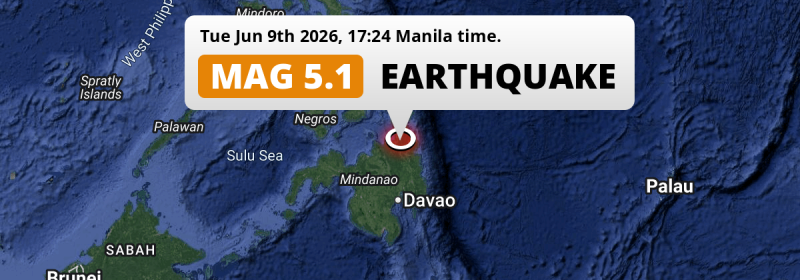
| Location: | 25 km SE of Butuan, Caraga, The Philippines. Coordinates 8°46'8"N 125°41'6"E. |
| Map: |  Map of area around epicenter. Click to open in Google Maps. |
| Magnitude: | MAG 5.1 Detected by 137 stations. Maximum Error Range ±0.049 . |
| Depth: | 10 km (6 mi) A very shallow depth. |
| Tsunami Risk: | Tsunami very unlikely While this was a shallow earthquake, it appears to have occurred under land with a magnitude not strong enough to cause tsunami's. Always stay cautious - More info here. |
Nearby towns and cities
This earthquake may have been felt in The Philippines . Located 9 kilometer (6 mi) west of the epicenter of this earthquake, Bayugan (Caraga, The Philippines) is the nearest significant population center.
Major cities near this earthquake: Butuan is located 25 km to the northwest. Libertad is located 28 km to the northwest. Davao is located 189 km to the south.
The table below provides an overview of all places in proximity of today's earthquake.
Overview of nearby places
| Distance | Place |
|---|---|
| 9 km (6 mi) E from epicenter |
Bayugan Caraga, The Philippines. |
| 25 km (16 mi) NW from epicenter |
Butuan Caraga, The Philippines. |
| 28 km (17 mi) NW from epicenter |
Libertad Caraga, The Philippines. |
| 31 km (19 mi) SE from epicenter |
Bah-Bah Caraga, The Philippines. |
| 36 km (22 mi) S from epicenter |
Talacogon Caraga, The Philippines. |
| 38 km (24 mi) NW from epicenter |
Buenavista Caraga, The Philippines. |
| 39 km (24 mi) SE from epicenter |
San Francisco Caraga, The Philippines. |
| 43 km (27 mi) NW from epicenter |
Cabadbaran Caraga, The Philippines. |
| 63 km (39 mi) W from epicenter |
Mariano Northern Mindanao, The Philippines. |
| 66 km (41 mi) NE from epicenter |
Tandag Caraga, The Philippines. |
| 75 km (47 mi) SE from epicenter |
Bunawan Caraga, The Philippines. |
| 83 km (52 mi) S from epicenter |
Veruela Caraga, The Philippines. |
| 91 km (57 mi) SE from epicenter |
Trento Caraga, The Philippines. |
| 92 km (57 mi) SW from epicenter |
Malaybalay Northern Mindanao, The Philippines. |
| 93 km (58 mi) SE from epicenter |
Bislig Caraga, The Philippines. |
| 101 km (63 mi) SW from epicenter |
Manolo Fortich Northern Mindanao, The Philippines. |
| 103 km (64 mi) W from epicenter |
Jasaan Northern Mindanao, The Philippines. |
| 105 km (65 mi) W from epicenter |
Tagoloan Northern Mindanao, The Philippines. |
| 106 km (66 mi) W from epicenter |
Bugo Northern Mindanao, The Philippines. |
| 114 km (71 mi) S from epicenter |
Monkayo Davao, The Philippines. |
| 115 km (71 mi) N from epicenter |
Surigao Caraga, The Philippines. |
| 116 km (72 mi) SW from epicenter |
NIA Valencia Northern Mindanao, The Philippines. |
| 118 km (73 mi) W from epicenter |
Cagayan de Oro Northern Mindanao, The Philippines. |
| 125 km (78 mi) SW from epicenter |
Dologon Northern Mindanao, The Philippines. |
| 130 km (81 mi) S from epicenter |
Compostela Davao, The Philippines. |
| 132 km (82 mi) S from epicenter |
New Corella Davao, The Philippines. |
| 132 km (82 mi) SW from epicenter |
Quezon Northern Mindanao, The Philippines. |
| 135 km (84 mi) SW from epicenter |
Maramag Northern Mindanao, The Philippines. |
| 142 km (88 mi) SW from epicenter |
Don Carlos Northern Mindanao, The Philippines. |
| 148 km (92 mi) S from epicenter |
Magugpo Poblacion Davao, The Philippines. |
| 153 km (95 mi) SW from epicenter |
Iligan City Soccsksargen, The Philippines. |
| 162 km (101 mi) S from epicenter |
Panabo Davao, The Philippines. |
| 170 km (106 mi) W from epicenter |
Iligan Northern Mindanao, The Philippines. |
| 175 km (109 mi) SW from epicenter |
Mantampay Northern Mindanao, The Philippines. |
| 175 km (109 mi) NW from epicenter |
Jagna Central Visayas, The Philippines. |
| 176 km (109 mi) SW from epicenter |
Marawi City Rehiyong Autonomo sa Muslim na Mindanao, The Philippines. |
| 188 km (117 mi) S from epicenter |
Samal Davao, The Philippines. |
| 189 km (117 mi) S from epicenter |
Davao Davao, The Philippines. |
| 210 km (130 mi) S from epicenter |
Mati Davao, The Philippines. |
| 222 km (138 mi) SW from epicenter |
Budta Rehiyong Autonomo sa Muslim na Mindanao, The Philippines. |
| 223 km (139 mi) SW from epicenter |
Malingao Soccsksargen, The Philippines. |
| 227 km (141 mi) S from epicenter |
Digos Davao, The Philippines. |
| 234 km (145 mi) SW from epicenter |
Cotabato Rehiyong Autonomo sa Muslim na Mindanao, The Philippines. |
| 256 km (159 mi) NW from epicenter |
Lapu-Lapu City Central Visayas, The Philippines. |
| 259 km (161 mi) NW from epicenter |
Mandaue City Central Visayas, The Philippines. |
| 261 km (162 mi) NW from epicenter |
Cebu City Central Visayas, The Philippines. |
| 269 km (167 mi) SW from epicenter |
Pagadian Zamboanga Peninsula, The Philippines. |
| 275 km (171 mi) NW from epicenter |
Ormoc Eastern Visayas, The Philippines. |
| 285 km (177 mi) N from epicenter |
Tacloban Eastern Visayas, The Philippines. |
| 286 km (178 mi) N from epicenter |
Panalanoy Eastern Visayas, The Philippines. |
| 287 km (178 mi) NW from epicenter |
Toledo Central Visayas, The Philippines. |
Aftershocks detected
This main shock was prefaced by 1 smaller foreshock. Nearby this earthquake a foreshock struck 2 days earlier. It measured a magnitude of 3.8
Overview of foreshocks and aftershocks
| Classification | Magnitude | When | Where |
|---|---|---|---|
| Foreshock | M 3.8 |
2 days earlier Jun 7, 2026 12:43PM (Manila Time) | 82 km (51 mi) E from Main Shock. |
| Main Shock This Earthquake |
M 5.1 |
Jun 9, 2026 05:24PM (Manila Time) | - |
More earthquakes coming?
Earthquakes can create aftershocks. These are generally at least 1 magnitude lower than any main shock, and as time passes the chance and strength of aftershocks decreases.
It's always adviced to be cautious of the risk of a larger shock following any significant earthquake, however this risk is fairly small. There is a roughly 94 percent change that no larger main shock will follow in the days following this earthquake.
Read: How to Stay Safe during an Earthquake (cdc.gov).Earthquakes like this happen often in the region
Earthquakes of this strength are very common in the region. This is the strongest earthquake to hit since May 24th, 2026, when a 5.5 magnitude earthquake hit 88 km (55 mi) further north-east. An even stronger magnitude 7.6 earthquake struck on December 2nd, 2023.
In total, 235 earthquakes with a magnitude of 5.1 or higher have been registered within 300km (186 mi) of this epicenter in the past 10 years. This comes down to an average of once every 16 days.
Tsunami very unlikely
While MAG-6.5+ earthquakes may cause tsunami's, it appears that the epicenter of this earthquake hit under land. In addition, the reported depth is deeper than 100km, making the risk of a tsunami even less likely. However always stay cautious and monitor advice from local authorities.
Tsunami Risk Factors
| Factor | Under Sea? | MAG-6.5 or stronger? | Shallow depth? |
|---|---|---|---|
| Explanation | Almost all tsunami's are caused by earthquakes with their epicenter under sea or very near the sea. However stay cautious in coastal areas as earthquakes on land may cause landslides into sea, potentially still causing a local tsunami. | Under MAG 6.5: Very unlikely to cause a tsunami. MAG 6.5 to 7.5: Destructive tsunami's do occur, but are uncommon. Likely to observe small sea level changes. MAG 7.6+: Earthquakes with these magnitudes might produce destructive tsunami's. |
Most destructive tsunami's are caused by shallow earthquakes with a depth between 0 and 100km under the surface of the earth. Deeper tsunami's are unlikely to displace to ocean floor. |
| This Earthquake | Not this earthquake. This earthquake appears to have struck on land far from any coast. |
Not this earthquake. This earthquake had a magnitude of 5.1. Earthquakes of this strength are unlikely to trigger a tsunami. |
This earthquake occurred at a depth of of 10 km (6 mi). Earthquakes this shallow could trigger a tsunami. |
Sources
Last updated 09/06/26 17:58 (). As more information on this earthquake becomes available this article will be updated. This article is automatically composed based on data originating from multiple sources.
- US Geographic Society (USGS): Earthquake us7000srpr
- European-Mediterranean Seismological Centre (EMSC): Earthquake 20260609_0000181
- Geonames.org: World Cities Database
- Google Maps: Static API
- Earthquakelist.org: Historic Earthquakes Database
Share this article:
