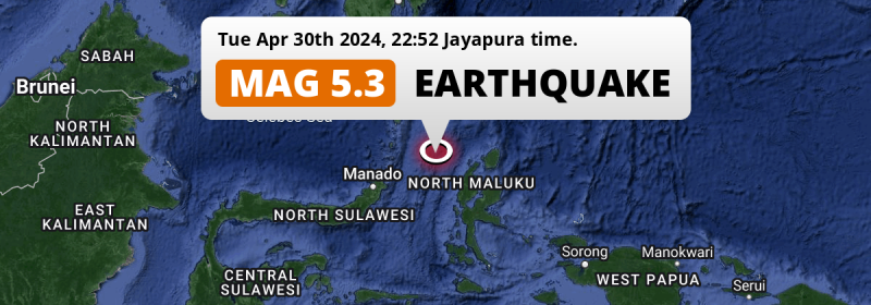
In the evening of Tuesday April 30th, 2024, a significant MAG-5.3 earthquake hit in the Maluku Sea 232 kilometer from Manado, Indonesia.
Felt the earthquake? Share this article: 


Earthquake Summary
This earthquake hit under water in the Maluku Sea, 109 kilometers (68 mi) off the coast of Indonesia, 232 kilometer east-northeast of Manado in North Sulawesi. The center of this earthquake had a quite shallow depth of 35 km. Shallow earthquakes usually have a larger impact than earthquakes deep in the earth.
| Date and Time: | Apr 30, 2024 22:52 (Jayapura Time) - Apr 30, 2024 13:52 Universal Time. |
|---|---|
| Location: | 232 km ENE of Manado, North Sulawesi, Indonesia. Coordinates 2°18'29"N 126°46'6"E. |
| Map: | 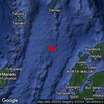 Map of area around epicenter. Click to open in Google Maps. |
| Magnitude: | MAG 5.3 Detected by 13 stations. Maximum Error Range ±0.086 . |
| Depth: | 35 km (22 mi) A quite shallow depth. |
| Tsunami Risk: | Low tsunami risk Earthquakes under MAG-6.5 do not usually cause tsunami's. Always stay cautious - More info here. |
Nearby towns and cities
This earthquake may have been felt in Indonesia . The closest significant population center near the earthquake is Ternate in North Maluku, Indonesia. Ternate is located 182 kilometer (113 mi) north-northwest of the epicenter.
The table below provides an overview of all places in proximity of today's earthquake.
Overview of nearby places
| Distance | Place |
|---|---|
| 182 km (113 mi) SSE from epicenter |
Ternate North Maluku, Indonesia. |
| 196 km (122 mi) SSE from epicenter |
Sofifi North Maluku, Indonesia. |
| 232 km (144 mi) WSW from epicenter |
Manado North Sulawesi, Indonesia. |
| 234 km (145 mi) WSW from epicenter |
Tondano North Sulawesi, Indonesia. |
| 245 km (152 mi) WSW from epicenter |
Tomohon North Sulawesi, Indonesia. |
5 Aftershocks detected
This main shock was followed by 5 smaller aftershocks. Just 4 days after this main shock, an earthquake measuring MAG-3.9 was detected 62 km (39 mi) east-southeast of this earthquake.
Before this earthquake struck, 2 smaller foreshocks occurred. Roughly 3 days before this earthquake, a foreshock measuring MAG-3.3 was detected nearby this earthquake.
Overview of foreshocks and aftershocks
| Classification | Magnitude | When | Where |
|---|---|---|---|
| Foreshock | M 3.3 |
3 days earlier Apr 26, 2024 17:29 (Jayapura Time) | 43 km (27 mi) SSW from Main Shock. |
| Foreshock | M 3.2 |
2 days earlier Apr 27, 2024 17:23 (Jayapura Time) | 93 km (58 mi) SSE from Main Shock. |
| Main Shock | M 4.4 |
Apr 29, 2024 12:03 (Jayapura Time) | - |
| Aftershock | M 2.5 |
16 hrs later Apr 30, 2024 03:57 (Jayapura Time) | 50 km (31 mi) SE from Main Shock. |
| Aftershock | M 2.7 |
3 days later May 2, 2024 02:50 (Jayapura Time) | 64 km (40 mi) SSW from Main Shock. |
| Aftershock | M 2.8 |
3 days later May 2, 2024 03:07 (Jayapura Time) | 13 km (8 mi) ESE from Main Shock. |
| Aftershock | M 3.5 |
4 days later May 3, 2024 00:49 (Jayapura Time) | 90 km (56 mi) WNW from Main Shock. |
| Aftershock | M 3.9 |
4 days later May 3, 2024 16:13 (Jayapura Time) | 62 km (39 mi) ESE from Main Shock. |
More earthquakes coming?
Aftershocks are usually at least 1 order of magnitude less strong than main shocks. The more time passes, the smaller the chance and likely strength of any potential aftershocks.
The chance that a significant earthquake like this one is followed by an even larger earthquake is not so large. On average, scientists estimate a 94% chance that a major earthquake will not be followed by an even larger one. It is still adviced to be aware of this risk
Read: How to Stay Safe during an Earthquake (cdc.gov).Earthquakes like this happen often in the region
Earthquakes of this strength are very common in the region. This is the strongest earthquake to hit since April 13th, 2024, when a 5.3 magnitude earthquake hit 29 km (18 mi) further southwest. An even stronger magnitude 7.1 earthquake struck on November 14th, 2019.
In total, 159 earthquakes with a magnitude of 5.3 or higher have been registered within 300km (186 mi) of this epicenter in the past 10 years. This comes down to an average of once every 23 days.
Low tsunami risk
Based on early data it appears this earthquake was not strong enough (lower than MAG-6.5) to be likely to cause destructive tsunami's. However this earthquake appeared to have hit at a shallow depth under sea, so stay cautious and monitor advice from local authorities.
Tsunami Risk Factors
| Factor | Under Sea? | MAG-6.5 or stronger? | Shallow depth? |
|---|---|---|---|
| Explanation | Almost all tsunami's are caused by earthquakes with their epicenter under sea or very near the sea. However stay cautious in coastal areas as earthquakes on land may cause landslides into sea, potentially still causing a local tsunami. | Under MAG 6.5: Very unlikely to cause a tsunami. MAG 6.5 to 7.5: Destructive tsunami's do occur, but are uncommon. Likely to observe small sea level changes. MAG 7.6+: Earthquakes with these magnitudes might produce destructive tsunami's. |
Most destructive tsunami's are caused by shallow earthquakes with a depth between 0 and 100km under the surface of the earth. Deeper tsunami's are unlikely to displace to ocean floor. |
| This Earthquake | This earthquake appears to have struck under the sea. | Not this earthquake. This earthquake had a magnitude of 5.3. Earthquakes of this strength are unlikely to trigger a tsunami. |
This earthquake occurred at a depth of of 35 km (22 mi). Earthquakes this shallow could trigger a tsunami. |
Sources
Last updated 19/05/24 15:58 (). This article is automatically generated based on available data. We keep checking multiple sources for additional information. This article gets updated as new details on this earthquake become available.
- US Geographic Society (USGS): Earthquake us6000mv6r
- European-Mediterranean Seismological Centre (EMSC): Earthquake 20240430_0000193
- Geonames.org: World Cities Database
- Google Maps: Static API
- Earthquakelist.org: Historic Earthquakes Database
Share this article:
