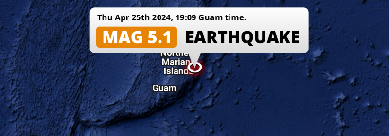
In the evening of Thursday April 25th, 2024, a shallow and significant MAG-5.1 earthquake hit 88 miles from Northern Mariana Islands. Another country near the epicenter is Guam.
Felt the earthquake? Share this article: 


Earthquake Summary
This earthquake struck 88 miles (142 km) from Northern Mariana Islands The center of this earthquake had a very shallow depth of 10 km. Shallow earthquakes usually have a larger impact than earthquakes deep in the earth.
| Date and Time: | Apr 25, 2024 19:09 (Saipan Time) - Apr 25, 2024 09:09 Universal Time. |
|---|---|
| Location: | 143 km ESE of Saipan, Northern Mariana Islands. Coordinates 14°33'30"N 146°53'51"E. |
| Map: | 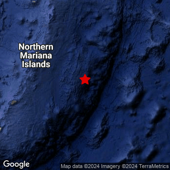 Map of area around epicenter. Click to open in Google Maps. |
| Magnitude: | MAG 5.1 Detected by 120 stations. Maximum Error Range ±0.052 . |
| Depth: | 10 km (6 mi) A very shallow depth. |
| Tsunami Risk: | Low tsunami risk Earthquakes under MAG-6.5 do not usually cause tsunami's. Always stay cautious - More info here. |
Nearby towns and cities
Northern Mariana Islands and Guam are both located within 300km distance of the epicenter of the earthquake.
The closest significant population center near the earthquake is Saipan in Saipan, Northern Mariana Islands. Saipan is located 143 kilometer (89 mi) east-southeast of the epicenter.
A complete list of nearby places is included below.
Overview of nearby places
| Distance | Place |
|---|---|
| 143 km (89 mi) WNW from epicenter |
Saipan Saipan, Northern Mariana Islands. |
| 245 km (152 mi) WSW from epicenter |
Yigo Village Yigo, Guam. |
| 250 km (155 mi) WSW from epicenter |
Dededo Village Dededo, Guam. |
| 257 km (160 mi) WSW from epicenter |
Tamuning-Tumon-Harmon Village Tamuning, Guam. |
| 257 km (160 mi) WSW from epicenter |
Tamuning Tamuning, Guam. |
| 258 km (160 mi) WSW from epicenter |
Mangilao Village Mangilao, Guam. |
| 261 km (162 mi) WSW from epicenter |
Hagåtña Hagatna, Guam. |
| 261 km (162 mi) WSW from epicenter |
Guam Government House Hagatna, Guam. |
Risk of aftershocks?
We monitor for foreshocks or aftershocks that have a magnitude of 2.5+ and occur within 100km (62 mi) of the epicenter of this earthquake. So far no such earthquakes have been detected.
The risk of aftershocks decreases rapidly over time. Usually, aftershocks are at least one order of magnitude lower than a main shock.
The chance that a significant earthquake like this one is followed by an even larger earthquake is not so large. On average, scientists estimate a 94% chance that a major earthquake will not be followed by an even larger one. It is still adviced to be aware of this risk
Read: How to Stay Safe during an Earthquake (cdc.gov).Earthquakes like this happen often in the region
Earthquakes of this strength are very common in the region. This is the strongest earthquake to hit since April 16th, 2024, when a 5.4 magnitude earthquake hit 243 km (151 mi) further southwest. An even stronger magnitude 6.7 earthquake struck on September 17th, 2014.
In total, 52 earthquakes with a magnitude of 5.1 or higher have been registered within 300km (186 mi) of this epicenter in the past 10 years. This comes down to an average of once every 2 months.
Low tsunami risk
Based on early data it appears this earthquake was not strong enough (lower than MAG-6.5) to be likely to cause destructive tsunami's. However this earthquake appeared to have hit at a shallow depth under sea, so stay cautious and monitor advice from local authorities.
Tsunami Risk Factors
| Factor | Under Sea? | MAG-6.5 or stronger? | Shallow depth? |
|---|---|---|---|
| Explanation | Almost all tsunami's are caused by earthquakes with their epicenter under sea or very near the sea. However stay cautious in coastal areas as earthquakes on land may cause landslides into sea, potentially still causing a local tsunami. | Under MAG 6.5: Very unlikely to cause a tsunami. MAG 6.5 to 7.5: Destructive tsunami's do occur, but are uncommon. Likely to observe small sea level changes. MAG 7.6+: Earthquakes with these magnitudes might produce destructive tsunami's. |
Most destructive tsunami's are caused by shallow earthquakes with a depth between 0 and 100km under the surface of the earth. Deeper tsunami's are unlikely to displace to ocean floor. |
| This Earthquake | This earthquake appears to have struck under the sea. | Not this earthquake. This earthquake had a magnitude of 5.1. Earthquakes of this strength are unlikely to trigger a tsunami. |
This earthquake occurred at a depth of of 10 km (6 mi). Earthquakes this shallow could trigger a tsunami. |
Sources
Last updated 08/05/24 00:18 (). This article is automatically generated based on available data. We keep checking multiple sources for additional information. This article gets updated as new details on this earthquake become available.
- US Geographic Society (USGS): Earthquake us6000mtmz
- European-Mediterranean Seismological Centre (EMSC): Earthquake 20240425_0000107
- Geonames.org: World Cities Database
- Google Maps: Static API
- Earthquakelist.org: Historic Earthquakes Database
Share this article:
