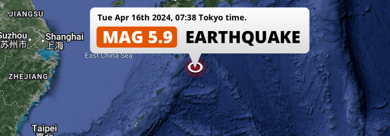
A shallow and significant M5.9 earthquake struck in the Philippine Sea 264 kilometer from Kagoshima, Japan in the morning of Tuesday April 16th, 2024. Roughly 80 thousand people may have felt this earthquake.
Felt the earthquake? Share this article: 


Earthquake Summary
This earthquake hit under water in the Philippine Sea, 139 kilometers (86 mi) off the coast of Japan, 264 kilometer south-southeast of Kagoshima. The center of this earthquake had a very shallow depth of 7 km. Shallow earthquakes usually have a larger impact than earthquakes deep in the earth.
| Date and Time: | Apr 16, 2024 07:38 (Tokyo Time) - Apr 15, 2024 22:38 Universal Time. |
|---|---|
| Location: | 264 km SSE of Kagoshima, Japan. Coordinates 29°26'7"N 131°46'24"E. |
| Map: | 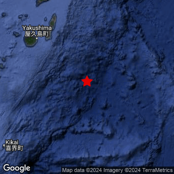 Map of area around epicenter. Click to open in Google Maps. |
| Magnitude: | MAG 5.9 Detected by 48 stations. Maximum Error Range ±0.045 . |
| Depth: | 7 km (5 mi) A very shallow depth. |
| Max. Intensity: | IV
Light On the Modified Mercalli Scale. |
| Tsunami Risk: | Low tsunami risk Earthquakes under MAG-6.5 do not usually cause tsunami's. Always stay cautious - More info here. |
Minimal impact predicted
Based on scientific estimates by the US Geographic Survey (USGS), the risk of high fatalities for this earthquake is classified at level GREEN (low). They expect an 65% likelyhood of between 0 and 1 fatalities, and a 96% chance that the number of fatalities falls no higher than 10.
The USGS classifies the economic impact of this earthquake at level GREEN (low). They expect an 65% likelyhood of between 0 and 1 million US Dollars in economic damage and impact, and a 96% chance that the economic impact of this earthquake falls no higher than 10 million USD.
Roughly 80 thousand people exposed to shaking
This earthquake may have been felt by around 80 thousand people. That is the expected population size of the area exposed to a level of shaking of II or higher on the Modified Mercalli scale according to the USGS.
Light shaking and likely no damage may have been experienced by an estimated 120 people. At IV, it is the highest MMI level this earthquake has caused. Intensity level III was experienced by the majority of people (around 80 thousand). In their region, weak shaking and probably no damage can be expected. All exposure to shaking was within the borders of Japan .
| People | MMI Level | Shaking | Damage |
|---|---|---|---|
| 0 | I |
Not noticable | None |
| 0 | II |
Very weak | None |
| 76,710 | III |
Weak | Probably none |
| 120 | IV |
Light | Likely none |
| 0 | V |
Moderate | Very light |
| 0 | VI |
Strong | Light |
| 0 | VII |
Very Strong | Moderate |
| 0 | VIII |
Severe | Moderate to heavy |
| 0 | IX |
Violent | Heavy |
| 0 | X |
Extreme | Very heavy |
Nearby towns and cities
This earthquake may have been felt in Japan . The closest significant population center near the earthquake is Nishinoomote in Kagoshima, Japan. Nishinoomote is located 162 kilometer (101 mi) south-southeast of the epicenter. The intensity of shaking and damage in Nishinoomote is estimated to be around level III on the Modified Mercalli Intensity scale (weak shaking, probably no damage).
Multiple major population centers exist within 300km of the earthquake that struck today. Kagoshima is located 264 km to the north-northwest (intensity unknown, possibly low). Kumamoto is located 389 km to the north-northwest (intensity unknown, possibly low). Miyazaki is located 278 km to the north (intensity unknown, possibly low).
A complete list of nearby places is included below. Estimated intensity data (MMI) sourced from a shake-map published by the US Geographic Survey is shown where available (cities without data probably experienced little impact).
Overview of nearby places
| Distance | Place | Intensity (MMI) |
|---|---|---|
| 162 km (101 mi) NNW from epicenter |
Nishinoomote Kagoshima, Japan. |
III
Weak |
| 227 km (141 mi) NNW from epicenter |
Ibusuki Kagoshima, Japan. |
|
| 234 km (145 mi) NNW from epicenter |
Kanoya Kagoshima, Japan. |
|
| 234 km (145 mi) NNW from epicenter |
Kushima Miyazaki, Japan. |
|
| 236 km (147 mi) NNW from epicenter |
Shibushi Kagoshima, Japan. |
|
| 244 km (152 mi) N from epicenter |
Nichinan Miyazaki, Japan. |
|
| 247 km (153 mi) NW from epicenter |
Makurazaki Kagoshima, Japan. |
|
| 250 km (155 mi) NNW from epicenter |
Tarumizu Kagoshima, Japan. |
|
| 253 km (157 mi) WSW from epicenter |
Naze Kagoshima, Japan. |
|
| 257 km (160 mi) NNW from epicenter |
Sueyoshichō-ninokata Kagoshima, Japan. |
|
| 261 km (162 mi) NNW from epicenter |
Kaseda-shirakame Kagoshima, Japan. |
|
| 264 km (164 mi) NNW from epicenter |
Kagoshima Kagoshima, Japan. |
|
| 264 km (164 mi) NNW from epicenter |
Miyakonojō Miyazaki, Japan. |
|
| 272 km (169 mi) NNW from epicenter |
Hamanoichi Kagoshima, Japan. |
|
| 273 km (170 mi) NNW from epicenter |
Kokubu-matsuki Kagoshima, Japan. |
|
| 276 km (171 mi) NNW from epicenter |
Ijūin Kagoshima, Japan. |
|
| 277 km (172 mi) NNW from epicenter |
Kajiki Kagoshima, Japan. |
|
| 278 km (173 mi) N from epicenter |
Miyazaki Miyazaki, Japan. |
|
| 292 km (181 mi) NNW from epicenter |
Kushikino Kagoshima, Japan. |
|
| 293 km (182 mi) NNW from epicenter |
Kobayashi Miyazaki, Japan. |
|
| 298 km (185 mi) N from epicenter |
Tsuma Miyazaki, Japan. |
|
| 300 km (186 mi) NNW from epicenter |
Satsumasendai Kagoshima, Japan. |
|
| 301 km (187 mi) N from epicenter |
Takanabe Miyazaki, Japan. |
|
| 307 km (191 mi) N from epicenter |
Kawaminami Miyazaki, Japan. |
|
| 313 km (194 mi) NNW from epicenter |
Ōkuchi-shinohara Kagoshima, Japan. |
|
| 324 km (201 mi) NNW from epicenter |
Akune Kagoshima, Japan. |
|
| 324 km (201 mi) NNW from epicenter |
Hitoyoshi Kumamoto, Japan. |
|
| 324 km (201 mi) NNW from epicenter |
Izumi Kagoshima, Japan. |
|
| 336 km (209 mi) NNW from epicenter |
Minamata Kumamoto, Japan. |
|
| 338 km (210 mi) N from epicenter |
Kadogawa Miyazaki, Japan. |
|
| 350 km (217 mi) NNW from epicenter |
Ushibukamachi Kumamoto, Japan. |
|
| 350 km (217 mi) N from epicenter |
Nobeoka Miyazaki, Japan. |
|
| 359 km (223 mi) NNW from epicenter |
Honmachi Kumamoto, Japan. |
|
| 370 km (230 mi) NNW from epicenter |
Hondomachi-hondo Kumamoto, Japan. |
|
| 373 km (232 mi) NNW from epicenter |
Matsubase Kumamoto, Japan. |
|
| 376 km (234 mi) NNW from epicenter |
Uto Kumamoto, Japan. |
|
| 376 km (234 mi) NNW from epicenter |
Mifune Kumamoto, Japan. |
|
| 389 km (242 mi) NNW from epicenter |
Kumamoto Kumamoto, Japan. |
|
| 391 km (243 mi) N from epicenter |
Saiki Ōita, Japan. |
|
| 393 km (244 mi) NNW from epicenter |
Ōzu Kumamoto, Japan. |
|
| 394 km (245 mi) N from epicenter |
Takedamachi Ōita, Japan. |
|
| 395 km (245 mi) N from epicenter |
Aso Kumamoto, Japan. |
|
| 396 km (246 mi) NNW from epicenter |
Shimabara Nagasaki, Japan. |
|
| 399 km (248 mi) NNW from epicenter |
Uekimachi-mōno Kumamoto, Japan. |
|
| 400 km (249 mi) NNE from epicenter |
Sukumo Kōchi, Japan. |
Earthquake Intensity Map
The maximum intensity (MMI Scale) caused by this earthquake is IV. The map below shows in which areas this earthquake was the most and least impactful. It is based on data from the US Geographic Survey.

Shaking reported by 1 person
People that feel an earthquake may report their experience to the US Geographic Survey. Currently, 1 person has reported shaking in one place in Japan.We keep updating this article as more ground reports become available. You may report that you felt this earthquake here.
Places with most reports:
- Kagoshima, Kagoshima, Japan: 1 person.
Risk of aftershocks?
We monitor for foreshocks or aftershocks that have a magnitude of 2.5+ and occur within 100km (62 mi) of the epicenter of this earthquake. So far no such earthquakes have been detected.
The risk of aftershocks decreases rapidly over time. Usually, aftershocks are at least one order of magnitude lower than a main shock.
It's always adviced to be cautious of the risk of a larger shock following any significant earthquake, however this risk is fairly small. There is a roughly 94 percent change that no larger main shock will follow in the days following this earthquake.
Read: How to Stay Safe during an Earthquake (cdc.gov).Earthquakes like this are common in the region
Earthquakes of this strength occur quite regularly in the region. This is the strongest earthquake to hit since December 9th, 2021, when a 6 magnitude earthquake hit 231 km (144 mi) further west. An even stronger magnitude 6.3 earthquake struck on January 8th, 2019.
In total, 4 earthquakes with a magnitude of 5.9 or higher have been registered within 300km (186 mi) of this epicenter in the past 10 years. This comes down to an average of once every 3 years.
Low tsunami risk
Based on early data it appears this earthquake was not strong enough (lower than MAG-6.5) to be likely to cause destructive tsunami's. However this earthquake appeared to have hit at a shallow depth under sea, so stay cautious and monitor advice from local authorities.
Tsunami Risk Factors
| Factor | Under Sea? | MAG-6.5 or stronger? | Shallow depth? |
|---|---|---|---|
| Explanation | Almost all tsunami's are caused by earthquakes with their epicenter under sea or very near the sea. However stay cautious in coastal areas as earthquakes on land may cause landslides into sea, potentially still causing a local tsunami. | Under MAG 6.5: Very unlikely to cause a tsunami. MAG 6.5 to 7.5: Destructive tsunami's do occur, but are uncommon. Likely to observe small sea level changes. MAG 7.6+: Earthquakes with these magnitudes might produce destructive tsunami's. |
Most destructive tsunami's are caused by shallow earthquakes with a depth between 0 and 100km under the surface of the earth. Deeper tsunami's are unlikely to displace to ocean floor. |
| This Earthquake | This earthquake appears to have struck under the sea. | Not this earthquake. This earthquake had a magnitude of 5.9. Earthquakes of this strength are unlikely to trigger a tsunami. |
This earthquake occurred at a depth of of 7 km (5 mi). Earthquakes this shallow could trigger a tsunami. |
Sources
Last updated 20/05/24 01:48 (). This article is automatically generated based on available data. We keep checking multiple sources for additional information. This article gets updated as new details on this earthquake become available.
- US Geographic Society (USGS): Earthquake us7000mcb1
- European-Mediterranean Seismological Centre (EMSC): Earthquake 20240415_0000193
- Geonames.org: World Cities Database
- Google Maps: Static API
- Earthquakelist.org: Historic Earthquakes Database
Share this article:
